
GIS Data Catalog
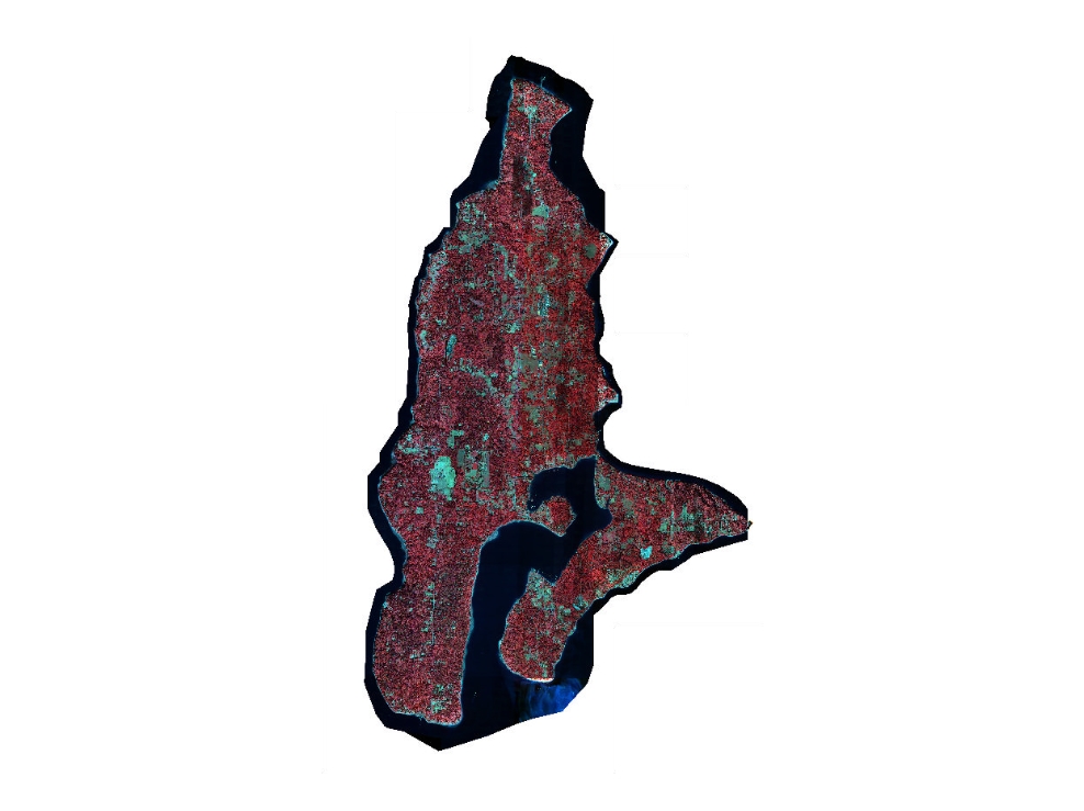
2000 DAIS Color Infrared 8-bit Aerial Photography
Learn more by reading the GIS FAQ 🗺
Summary
The image dataset comprises 25 individual image tiles stored in TIFF format that can be displayed as a single seamless mosaic.
The original imagery was 12-bit, 4-band multispectral data.
This dataset is a conversion of the original to 8-bit, 3-band data (red band omitted) that is more easily viewed with common software than the original multispectral data.
The imagery, within the horizontal accuracy and resolution limitations, serves as digital backdrop imagery for GIS analysis and cartographic display.
This 'false color' format displays the infrared band by default making it useful for visual analysis of vegetative vs non-vegetative characteristics.
However the data is not intended to be used for true multispectral analysis as it is missing the one band and is of lower dynamic range than the original data.
Absolute and relative horizontal accuracy of the data should be carefully considered when either determining coordinate positions or when applying the data relative to other spatial datatsets.
Description
Color Infrared version of low elevation, high resolution (i.e., small ground sample distance (GSD)) aerial photography collected in September 2000 for Vashon and Maury Islands.
portions of King County that reside in Puget Sound, approximately 5 miles west of the city of Seattle.The data has a pixel size of 0.5 meters and is displayed in color infrared for 'false color' viewing and analysis.
Layer information
| Layer Name | IMAGE_Ortho2000DAISCIR |
| Subject Category | Imagery |
| Title | 2000 DAIS Color Infrared 8-bit Aerial Photography |
| Feature Count | 1 |
| Feature Type | Raster |
| Next Update | None planned |
| Spatial reference | None |
| Control ID | None |
| Place Keywords | Pacific NW, Washington, King County (Vahson/Maury Islands), Pacific Northwest |
| Theme Keywords | Multispectral, Caterra, DAIS, Space Imaging, Color Infrared Imagery, Digital Airborne Imagery System, 'False Color', Aerial Photography, Imagerybasemapsearthcover |
| Supplemental Information |
The images can be accessed as individual TIFFs tile by tile or as a pseudo-mosaic by using the associated image catalog dbase file (dais_cir.dbf). Some of the images demonstrate some spectral balance variation, especially where there is a large amount of water in the image. This appears to be due to the way the display look-up table handles the display contast. Additional adjustments may be made to this data in future to improve the display chararcteristics. The TIFF format, though most appropriate for ArcView viewing, do not display properly in ArcView Image Analyst due to a bug in the way Image Analyst reads the Geotiff header. For this reason it is not recommended that this imagery be viewed or analyzed in Image Analyst. This projection read error is also documented in Erdas although there is a patch fix to take care of this. Users who wish to take advantage of the full multispectral characteristics of the DAIS imagery are encouraged to use the true multispectral version of the data, ms16xx.img |
Attribute information
|
OBJECTID
From Esri |
Description
Internal feature number. DomainSequential unique whole numbers that are automatically generated. |
|
Shape
From Esri |
Description
Feature geometry. DomainCoordinates defining the features. |
|
MosaicID
No Source Noted |
Description
Not Found DomainNot Found |
|
SHAPE_Length
From Esri |
Description
Length of feature in internal units. DomainPositive real numbers that are automatically generated. |
|
SHAPE_Area
From Esri |
Description
Area of feature in internal units squared. DomainPositive real numbers that are automatically generated. |
Contact information
| Maintained by | KCGIS Center |
| Primary |
KCGIS Center
giscenter@kingcounty.gov |
Terms of Use
| License | Terms of use and copyright |
Summary
The image dataset comprises 25 individual image tiles stored in TIFF format that can be displayed as a single seamless mosaic.
The original imagery was 12-bit, 4-band multispectral data.
This dataset is a conversion of the original to 8-bit, 3-band data (red band omitted) that is more easily viewed with common software than the original multispectral data.
The imagery, within the horizontal accuracy and resolution limitations, serves as digital backdrop imagery for GIS analysis and cartographic display.
This 'false color' format displays the infrared band by default making it useful for visual analysis of vegetative vs non-vegetative characteristics.
However the data is not intended to be used for true multispectral analysis as it is missing the one band and is of lower dynamic range than the original data.
Absolute and relative horizontal accuracy of the data should be carefully considered when either determining coordinate positions or when applying the data relative to other spatial datatsets.
Description
Color Infrared version of low elevation, high resolution (i.e., small ground sample distance (GSD)) aerial photography collected in September 2000 for Vashon and Maury Islands.
portions of King County that reside in Puget Sound, approximately 5 miles west of the city of Seattle.The data has a pixel size of 0.5 meters and is displayed in color infrared for 'false color' viewing and analysis.
Contact information
| Maintained by | KCGIS Center |
| Primary |
KCGIS Center
giscenter@kingcounty.gov |
Terms of use and copyright
| License | Terms of use and copyright |
Change history
| 1/1/2001 |
The original 16-bit images do not display nor are able to be manipulated in ArcInfo and ArcView software without special extensions. To create a version of the data for 'False Color' Infrared viewing that could be viewed without specialized software, a proprietary application supplied by Space Imaging called 'make8bit' was used.This application performed a color-balanced conversion of the data by decreasing the dynamic range from 16 to 8 bits and omitting the red band. This created a blue (3),green(2),NIR(1) 3-band image that defaults to NIR band display order in ArcView. |
| 12/1/2000 |
The images were received from the vendor on CDROM as 4-band (blue, green, red, near infrared) TIFF files in 12-bit (stretched to 16-bit) format. Twenty-five (25) tiles (files) were delivered. The original file name was in the format LLWWWCR where LL was the latitude of the SE corner of the the tile, WWW was the longitude of the SE corner of the tile, C was an arbitrary column letter and R was an arbitrary row number. To maintain consistency with the other datasets in this project, the tiles (files) were renamed to a sequential numbering order from 1 through 25, corresponding to the edited spatial index. The tile numbers were prefaced with 'ms16' to indicate that they were the raw 16-bit multispectral image files. |