
GIS Data Catalog
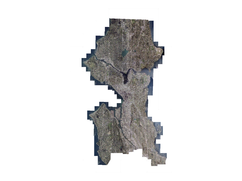
2005 City of Seattle Natural Color Orthophotography
Learn more by reading the GIS FAQ 🗺
Summary
Archival orthophotos for City of Seattle area
Description
One-half-foot natural color orthophotography obtained from the City of Seattle, limited to city limits.
Data was acquired under early leaf-on conditions.
Layer information
| Layer Name | IMAGE_Ortho2005SeattleNAT |
| Subject Category | Imagery |
| Title | 2005 City of Seattle Natural Color Orthophotography |
| Feature Count | 1 |
| Feature Type | Raster |
| Next Update | None planned |
| Spatial reference | None |
| Control ID | None |
| Place Keywords | WA, City Of Seattle, Washington State, King County, Pacific NW |
| Theme Keywords | Imagerybasemapsearthcover, 0Rthophotography, Natural Color Orthoimagery, Orthophotography |
| Supplemental Information |
Original data was provided by the Originator in their tiling scheme. Data was retiled to standard tiling scheme for King County. Data is available as TIFF and MrSid compressed versions. TIFF format data is available only at the base tiling level - idxp7500 - defined by a rectangular grid of cells with x-y dimensions of 7500 feet. Primary user data is provided at second tier tiling level - idxptrmbr. This tiling level references the PLSS township-range grid with tiles buffered to a minimum-bounding rectangle of the township. Imagery at this level is provided only as compressed (compression ratio = 7, near lossless) imagery in JPG2000 format. Imagery is also available as larger area mosaics at the idxpzone level (if appropriate) and as a highly compressed entire area of interest mosaic. Both the zone and entire area mosaic, called key region, is provided only as MrSid images. |
Attribute information
|
OBJECTID
From Esri |
Description
Internal feature number. DomainSequential unique whole numbers that are automatically generated. |
|
Shape
From Esri |
Description
Feature geometry. DomainCoordinates defining the features. |
|
Shape_Length
From Esri |
Description
Length of feature in internal units. DomainPositive real numbers that are automatically generated. |
|
Shape_Area
From Esri |
Description
Area of feature in internal units squared. DomainPositive real numbers that are automatically generated. |
|
MosaicID
No Source Noted |
Description
Not Found DomainNot Found |
Contact information
| Maintained by | KCGIS Center |
| Primary |
KCGIS Center
giscenter@kingcounty.gov |
Terms of Use
| License | Terms of use and copyright |
Summary
Archival orthophotos for City of Seattle area
Description
One-half-foot natural color orthophotography obtained from the City of Seattle, limited to city limits.
Data was acquired under early leaf-on conditions.
Contact information
| Maintained by | KCGIS Center |
| Primary |
KCGIS Center
giscenter@kingcounty.gov |
Terms of use and copyright
| License | Terms of use and copyright |