
GIS Data Catalog
2009 Aerials Express Color Infrared Orthoimagery
Learn more by reading the GIS FAQ 🗺
Summary
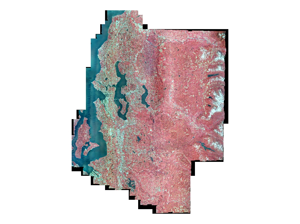
Color infrared orthophoto imagery for King Co and portions of adjoining counties.
Imagery has an infrared band in place of the blue band of regular RGB natural color imagery.
Imagery can be used for vegetative analysis and for impervious surface classification.
Description
Year 2009 (May/June) Aerials Express color infrared orthoimagery acquired by King County for internal business and agency use only.
Pixel resolution is 1.0 foot and coverage is western, urbanized, portions of King County, southwestern Snohomish County and a buffer into Pierce County.
Layer information
| Layer Name | IMAGE_Ortho2009AerialsExpressCIR |
| Subject Category | Imagery |
| Title | 2009 Aerials Express Color Infrared Orthoimagery |
| Feature Count | 1 |
| Feature Type | Raster |
| Next Update | None planned |
| Spatial reference | None |
| Control ID | None |
| Place Keywords | United States, King County; WA, Washington State, Pacific NW |
| Theme Keywords | Orthophotography, Color Infrared Imagery, Orthoimagery, Imagerybasemapsearthcover |
| Supplemental Information |
None |
Attribute information
|
OBJECTID
From Esri |
Description
Internal feature number. DomainSequential unique whole numbers that are automatically generated. |
|
Shape
From Esri |
Description
Feature geometry. DomainCoordinates defining the features. |
|
Shape_Length
From Esri |
Description
Length of feature in internal units. DomainPositive real numbers that are automatically generated. |
|
Shape_Area
From Esri |
Description
Area of feature in internal units squared. DomainPositive real numbers that are automatically generated. |
|
MosaicID
No Source Noted |
Description
Not Found DomainNot Found |
Contact information
| Maintained by | KCGIS Center |
| Primary |
KCGIS Center
giscenter@kingcounty.gov |
Terms of Use
| License | Terms of use and copyright |
Summary
Color infrared orthophoto imagery for King Co and portions of adjoining counties.
Imagery has an infrared band in place of the blue band of regular RGB natural color imagery.
Imagery can be used for vegetative analysis and for impervious surface classification.
Description
Year 2009 (May/June) Aerials Express color infrared orthoimagery acquired by King County for internal business and agency use only.
Pixel resolution is 1.0 foot and coverage is western, urbanized, portions of King County, southwestern Snohomish County and a buffer into Pierce County.
Contact information
| Maintained by | KCGIS Center |
| Primary |
KCGIS Center
giscenter@kingcounty.gov |
Terms of use and copyright
| License | Terms of use and copyright |
Change history
| 2/1/2010 |
The data had been tiled to King County's 7500 tiling scheme by Aerial Express. Tiles were loaded to SDW and inventoried. The 7500-ft tiles were built into township SID files (15x compression) using a python-driven MrSid routine. Zone (30x compression) and KeyRegion (75x compression) mosaics were also built. |
| 1/1/2010 |
Data acquired from Aerials Express in January 2010 via portable harddrive. Original delivery did not contain all the required tiles. Aerials Express resubmitted the project area in its entirety in the second harddrive delivery. |