
GIS Data Catalog
2015 Western Washington Regional Orthophotography - 4-band (RGBIr) with 2 Foot Pixel Resolution
Learn more by reading the GIS FAQ 🗺
Summary
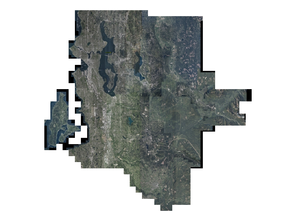
This data set was produced to provide (2 ft) pixel resolution, 16-bit depth, RGBIr orthophotography for the 2015 Western Washington Regional Aerial update, a multi-agency collaborative project.
Description
This data set contains 2 Foot, 4-band (RGBIr), 16-bit/band color orthophotography that covers a large and mostly contiguous urban area in the Puget Sound area of western Washington.
An orthophotograph is an aerial photograph that is geometrically corrected using a 3D terrain surface so that the scale is uniform and the image lacks distortion, allowing for highly accurate horizontal measurement of most ground-level features.Over 1,200 square miles of digital aerial imagery suitable for 2 foot orthophotography was acquired by GeoTerra, Inc. in the spring of 2015 for the purpose of updating regional base mapping data.
The regional project was a collaborative effort between multiple agencies primarily within the Puget Sound region.
King County oversaw the project and acted as lead manager for the effort on behalf of 88 participants.
The aerial imagery was acquired using multiple, large-format digital mapping cameras.
Overlapping stereo imagery was aerially-triangulated into large block adjustments using new and existing surveyed control.
Existing terrain data was updated, or in some areas newly acquired, and used for rectifying the aerial imagery into digital orthophoto mosaics.
These ortho image files are in a 3000' x 3000' contiguous, non-overlapping tile structure and are available in uncompressed GeoTIFF format.
Each are projected to NAD 83/91(HARN), Western Washington State Plane North Zone, US Feet.
Layer information
| Layer Name | IMAGE_Ortho2015CITYCIR |
| Subject Category | Imagery |
| Title | 2015 Western Washington Regional Orthophotography - 4-band (RGBIr) with 2 Foot Pixel Resolution |
| Feature Count | 2 |
| Feature Type | Raster |
| Next Update | None planned |
| Spatial reference | None |
| Control ID | None |
| Place Keywords | King County, Washington, WA, Pierce County, Snohomish County, US, Kitsap County, Skagit County |
| Theme Keywords | 4-Band Orthophotography, Orthos, Orthophotography, Aerial Imagery, Rgbir Orthos, 16-Bit, Color Infrared, Imagerybasemapsearthcover |
| Supplemental Information |
https://www5.kingcounty.gov/sdc/addl_doc/2015AerialsProjectReports.htm |
Attribute information
|
OBJECTID
From Esri |
Description
Internal feature number. DomainSequential unique whole numbers that are automatically generated. |
|
Shape
From Esri |
Description
Feature geometry. DomainCoordinates defining the features. |
|
MosaicID
No Source Noted |
Description
Not Found DomainNot Found |
|
Shape_Length
From Esri |
Description
Length of feature in internal units. DomainPositive real numbers that are automatically generated. |
|
Shape_Area
From Esri |
Description
Area of feature in internal units squared. DomainPositive real numbers that are automatically generated. |
Contact information
| Maintained by | KCGIS Center |
| Primary |
KCGIS Center
giscenter@kingcounty.gov |
Terms of Use
| License | Terms of use and copyright |
Summary
This data set was produced to provide (2 ft) pixel resolution, 16-bit depth, RGBIr orthophotography for the 2015 Western Washington Regional Aerial update, a multi-agency collaborative project.
Description
This data set contains 2 Foot, 4-band (RGBIr), 16-bit/band color orthophotography that covers a large and mostly contiguous urban area in the Puget Sound area of western Washington.
An orthophotograph is an aerial photograph that is geometrically corrected using a 3D terrain surface so that the scale is uniform and the image lacks distortion, allowing for highly accurate horizontal measurement of most ground-level features.Over 1,200 square miles of digital aerial imagery suitable for 2 foot orthophotography was acquired by GeoTerra, Inc. in the spring of 2015 for the purpose of updating regional base mapping data.
The regional project was a collaborative effort between multiple agencies primarily within the Puget Sound region.
King County oversaw the project and acted as lead manager for the effort on behalf of 88 participants.
The aerial imagery was acquired using multiple, large-format digital mapping cameras.
Overlapping stereo imagery was aerially-triangulated into large block adjustments using new and existing surveyed control.
Existing terrain data was updated, or in some areas newly acquired, and used for rectifying the aerial imagery into digital orthophoto mosaics.
These ortho image files are in a 3000' x 3000' contiguous, non-overlapping tile structure and are available in uncompressed GeoTIFF format.
Each are projected to NAD 83/91(HARN), Western Washington State Plane North Zone, US Feet.
Contact information
| Maintained by | KCGIS Center |
| Primary |
KCGIS Center
giscenter@kingcounty.gov |
Terms of use and copyright
| License | Terms of use and copyright |
Change history
| 12/31/2016 |
7. Aerial Triagulation (AT) of all imagery acquired for 3-inch (0.25') pixel resolution orthos using processed Airborn GPS photo centers and new and existing surveyed ground control. |
| 4/30/2016 |
6. Rectification and mosaicing of all aerial photos using Inpho OrthoVista software, with the combined input of AT, updated DTM and seamlines. |
| 4/1/2016 |
8. After initial Quality Assessment (QA) of the tiles by GeoTerra, additional QA was performed by Miller Creek Aerials Mapping (MCA). This evaluation was both quantitative and qualitative and was performed for a high percentage of tiles in each production zone, usually 50-75%,or greater, of the tiles. Calls were defined geographically and attributed as to type of issue and signficance. The RGB tiles were also evaluated by affected participants via a ArcGIS Online data portal maintained by GeoTerra. Combined calls, those from MCA and from the participants, were assembled. Review by GeoTerra and MCA, and when needed, by a working group of participants resulted in a final call list of issues that required repair. Upon completion of all fixes, the tiles went through final approval by GeoTerra and MCA prior to being delivered to King County. The county then distributed the data to each participant for their defined area of interest. |
| 3/31/2016 |
5. The most nadir portion of every photo was identified by creating "seamlines" used to stitch the rectified images together. Seamlines were created using a combination of automatic and manual methods. Inpho's Ortho Master software was utilized to collect or manually adjust the seamlines polygons. |
| 2/24/2016 |
4. Update of the existing Digital Terrain Model (DTM) to use for rectifying the images. Stereo photography, as a product of the aerial triangulation, was used to update the breakline and point data in a 3D stereo environment. |
| 6/15/2015 |
3. Acquisition of 4-band, 16 bit/band, digital aerial imagery at less than 0.225 ft pixel resolution using multiple Vexcel UltraCam aerial mapping cameras (Hawk, X, Xp and Eagle) during leaf-off and high sun-angle conditions. Each flight occured with AGPS and IMU. Enhanced areas of acquisition were acquired at higher image overlap and during a high sun-angle window to minimize buidling lean and shadows in identified dense urban areas. Post-flight, raw images were processed using propietary UltraMap software into full-histogram (unclipped) images in a final *.TIF format. |
| 6/1/2015 |
2. Airborne GPS processing. |
| 3/18/2015 |
1. Flight Planning for image acquistion occured in March of 2015 prior to flight. Multiple aerial flight vendors were subcontracted by GeoTerra to help ensure imagery was captured in a timely manner given seasonal weather and sun angle constraints. The project was broken into multiple blocks suitable for concurrent and multi-flight acquistion. All flights were planned and flown to acquire photos with a minimum 60% forward overlap and 30% sidelap. Several areas of the project identifid as Enhanced Aquisition Areas (EAA) were incorporated into the flight plan which were based on the client's requirements for minimal shadows and reduction of lean of elevated strutures. These areas were flown during a two hour window of highest sun angle. EAA with tall buildings were specifically flown so that all photos were acquired with 80% froward overlap and 60% sidelap of imagery to help reduce lean of elevated buildings and structures. |