
GIS Data Catalog
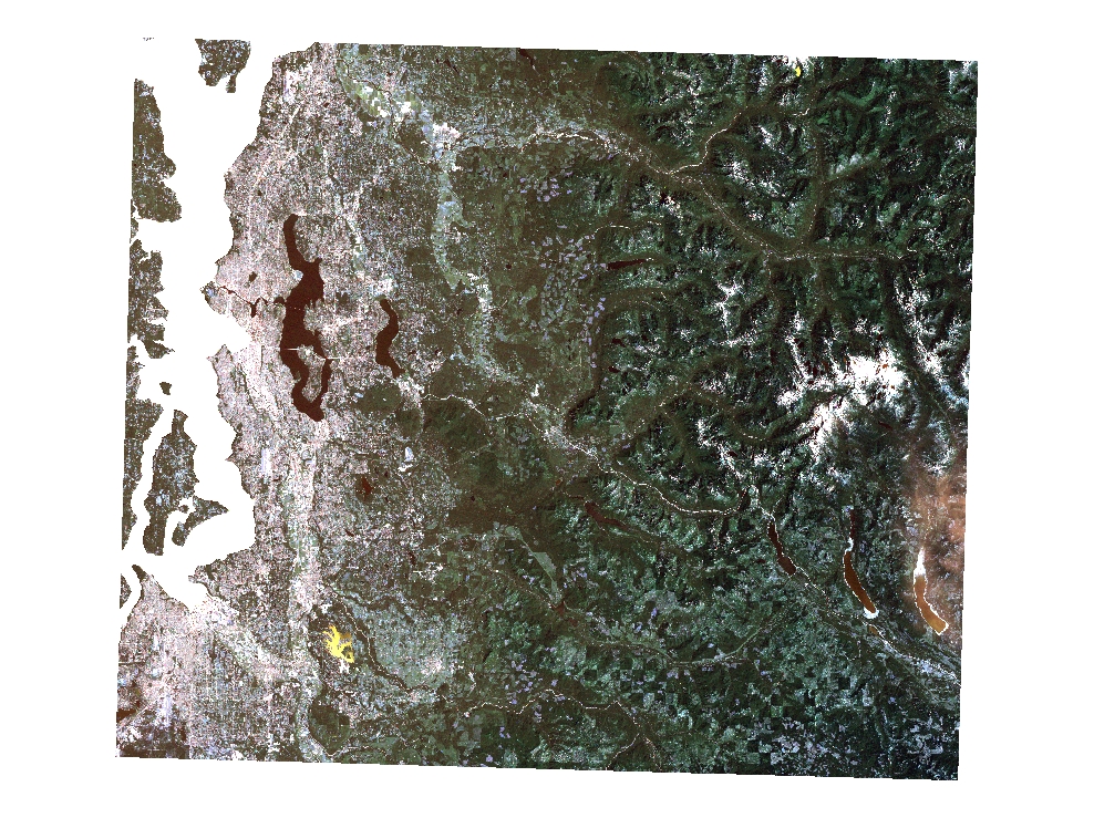
1994 Multispectral Landsat and Thematic Mapper
Learn more by reading the GIS FAQ 🗺
Summary
For general historical comparison at available resolution.
These data can bedisplayed in most GIS and imaging software as natural color.
The data are not intended for multispectral analysis as complete documentation for scene processing is not available for all images.Several of the scenes were the basis for Landcover/Landuse analyses.
Refer to metadata in the Landcover section of the Raster Data Catalog for details.
Description
Various Landsat and Thematic Mapper scenes from 1987 through 2001.
Includes both single-band and multi-band images.
Most images do not include full band depth as provided in original imagery though several contain more than 3-bands.
Layer information
| Layer Name | IMAGE_Satellite1994Multispectral |
| Subject Category | Imagery |
| Title | 1994 Multispectral Landsat and Thematic Mapper |
| Feature Count | 1 |
| Feature Type | Raster |
| Next Update | None planned |
| Spatial reference | None |
| Control ID | None |
| Place Keywords | WA, Snohomish County, Pierce County, Washington State, King County, Pacific NW |
| Theme Keywords | Thematic Mapper, Multiband Image, Satellite Image, Landsat |
| Supplemental Information |
Available images: Vintage/type: 2001 Landsat multiband summer scene KC File name: reg_01s82f Details: 6-band Thematic Mapper scene (August 11) Addl documentation: Vintage/type: 2000 Landsat panchromatic summer scene KC File name: reg_00p42f Details: 1-band Thematic Mapper scene (band 8 panchromatic-July 7) Addl documentation: https://www5.kingcounty.gov/sdc/raster/ortho/reg_00p42f.txt Vintage/type: 2000 Landsat panchromatic winter scene KC File name: reg_00p41f Details: 1-band Thematic Mapper. scene (band 8 panchromatic-January 29) Addl documentation: https://www5.kingcounty.gov/sdc/raster/ortho/reg_00p41f.txt Vintage/type: 2000 Landsat multiband winter scene KC File name: reg_00s82f Details: 6-band Thematic Mapper scene (January 29) Addl documentation: https://www5.kingcounty.gov/sdc/raster/ortho/reg_00s82f.txt Vintage/type: 2000 Landsat multiband summer scene KC File name: reg_00s83f Details: 6-band Thematic Mapper scene (July 7) Addl documentation:. https://www5.kingcounty.gov/sdc/raster/ortho/reg_00s83f.txt Vintage/type: 1999 Landsat multiband scene KC File name: reg_99s98f Details: 4-band Thematic Mapper scene Addl documentation: Vintage/type: 1999 Landsat pan-sharpened multiband scene KC File name: reg_99s49f Details: 4-band Thematic Mapper scene (pan-sharpened) Addl documentation: Vintage/type: 1987 Landsat multiband scene KC File name: reg_87s66f Details: 3-band Thematic Mapper scene (September 7) Addl documentation: Vintage/type: 1995. Landsat multiband scene KC File name: reg_95s82f Details: 7-band Landsat scene Addl documentation: Vintage/type: 1994 Landsat multiband summer scene KC File name: reg_94s82f Details: 6-band Thematic Mapper scene (July 31) Addl documentation: Vintage/type: 1991 Spot multiband scene KC File name: reg_91s66f Details: 3-band SPOT image Addl documentation: |
Attribute information
|
OBJECTID
From ESRI |
Description
Internal feature number. DomainSequential unique whole numbers that are automatically generated. |
|
Shape
From ESRI |
Description
Feature geometry. DomainCoordinates defining the features. |
|
Shape_Length
From Esri |
Description
Length of feature in internal units. DomainPositive real numbers that are automatically generated. |
|
Shape_Area
From Esri |
Description
Area of feature in internal units squared. DomainPositive real numbers that are automatically generated. |
|
MosaicID
No Source Noted |
Description
Not Found DomainNot Found |
Contact information
| Maintained by | KCGIS Center |
| Primary |
KCGIS Center
giscenter@kingcounty.gov |
Terms of Use
| License | Terms of use and copyright |
Summary
For general historical comparison at available resolution.
These data can bedisplayed in most GIS and imaging software as natural color.
The data are not intended for multispectral analysis as complete documentation for scene processing is not available for all images.Several of the scenes were the basis for Landcover/Landuse analyses.
Refer to metadata in the Landcover section of the Raster Data Catalog for details.
Description
Various Landsat and Thematic Mapper scenes from 1987 through 2001.
Includes both single-band and multi-band images.
Most images do not include full band depth as provided in original imagery though several contain more than 3-bands.
Contact information
| Maintained by | KCGIS Center |
| Primary |
KCGIS Center
giscenter@kingcounty.gov |
Terms of use and copyright
| License | Terms of use and copyright |