
GIS Data Catalog
2000 Impervious/Impacted Surface Interpretation based for King County
Learn more by reading the GIS FAQ 🗺
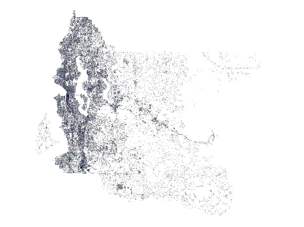
Summary
Provide a project-wide (King County and southwest Snohomish county) generalized interpretation of imperviuos and impacted By exclusion, null value areas imply vegetated or water.
Can to be used, within limitations of accuracy, to determine the distribution of these types of surfaces across the project area and to make first-order areal calculations.
This dataset is coincident in extent with other ESA/SAO datasets acquired during this three-year project scope, such as lidar elevation data and orthophotography.
Opportunities exist for synergistic applications.
Description
Impervious and heavily-impacted landcover surface interpretation derived from spectral classification of a three-part multispectral image dataset.
Limitations to classification extraction required substantial editing of initial results to improved data quality and reach required accuracy (approximately 90%).Includes mostly surfaces with high to completed impermeability, such as concrete, asphalt, roofing materials and other sealed surfaces.Examples include:(a) building roof tops regardless of composition or construction,(b) roadways, highways and parking lots constructed of concrete or asphalt,(c) parking areas with a high density of.
parked vehicles as represented by the imagery,(d) sidewalks, pedestrian walkways and malls constructed of concrete, asphalt or brick,(e) other prepared surfaces such as bicycle paths, tennis courts and running paths.In addition to spectral extraction limitations, visual interpretation during editing resulted in categorization encompassing both impervious surfaces as well as unvegetated, high-reflectance surfaces that are not covered by impervious materials.Often these surfaces are the result of.
anthropic operations that have resulted in removal of vegetation and compaction of the This "impacted surface" category includes gravel roads and parking lots, equipment staging areas, and sites prepared during pre-construction.
However it may also include naturally occurring sites that had little or no vegetation, and not necessarily been altered by man.
The original spectral interpretation had a high commission error, meaning areas clearly not impervious by definition, such as water bodies, streams, shadows, and dark (wet) grass areas, were incorporated into the interpretation.
This error was intentionally allowed in order to maximize the inclusion of true impervious areas that are of small areal extent or narrow width or may have been missed otherwise due to marginal spectral signature.
Most of the value-added editing focused on removing the gross commission error, particularly that of large areal extent.
Not all commission error has been removed.
Multispectral data used in this interpretation was acquired under leaf-on conditions.Impervious surfaces such as rooftops, roadways and parking lots are often partially obscured by the leaf cover.
These areas are not interpreted as impervious and are part of the omission error.
To reduce the omission error, a high accuracy road centerline dataset was incorporated into the original interpration to 'fill-in' roads where leaf overhang may have masked the
Layer information
| Layer Name | LANDCOVER_Landcover2000Impervious |
| Subject Category | Imagery |
| Title | 2000 Impervious/Impacted Surface Interpretation based for King County |
| Feature Count | 1 |
| Feature Type | Raster |
| Next Update | As needed |
| Spatial reference | None |
| Control ID | None |
| Place Keywords | Pacific NW, Puget Sound Lowlands, Washington, Southwestern Snohomish County, Western Cascade Mountains, King County, State Of Washington, United States, WA, Pacific Northwest |
| Theme Keywords | Buildings, Roads And Streets, Asphalt, Concrete, Impervious Surface, Manmade Surface, Parking Lots, Impacted Surface, Non-Permeable Surface, Transportation |
| Supplemental Information |
These impervious surface distributions were created by Marshall and Associates, Inc. as part of a multiple part effort to interpret impervious surface categories from high-resolution multispectral imagery. The interpretation was derived from three different multispectral imagery datasets covering the entire project area. The datasets had different spectral characteristics and resolutions resulting in differences in the output, both in quality, definition and resolution. Vashon Island was interpreted from 4-band, 12-bit rgb-infrared, 1.64 meter ground sample distance (gsd) data. Western King County and southwestern Snohomish County from Range 03 to Range 07 was interpreted from 3-band, 8-bit rg-infrared, 2 foot gsd data. Eastern King County from Range 08 to Range 11 was interpreted from 4-band, 16-bit, rgb-infrared 4-meter data. At the primary user-access level (township-range, idxptrmbr tiling level) the Vashon and western King County data are stored at 2-foot grids. The eastern King County data is stored at 15-foot grids. Background Project Review documents: Classification and Product Specifications: "< https://www5.kingcounty.gov/sdc/raster/landcover/MultispectralClassificationAndProductsSpecifications.doc >" Imagery Assessment and Processing Procedures: "< https://www5.kingcounty.gov/sdc/raster/landcover/MultispectralClassificationAssessmentAndProcessing.doc >" |
Attribute information
|
OBJECTID
From Esri |
Description
Internal feature number. DomainSequential unique whole numbers that are automatically generated. |
|
Shape
From Esri |
Description
Feature geometry. DomainCoordinates defining the features. |
|
Shape_Length
From Esri |
Description
Length of feature in internal units. DomainPositive real numbers that are automatically generated. |
|
Shape_Area
From Esri |
Description
Area of feature in internal units squared. DomainPositive real numbers that are automatically generated. |
|
MosaicID
No Source Noted |
Description
Not Found DomainNot Found |
Contact information
| Maintained by | KCGIS Center |
| Primary |
KCGIS Center
giscenter@kingcounty.gov |
Terms of Use
| License | Terms of use and copyright |
Summary
Provide a project-wide (King County and southwest Snohomish county) generalized interpretation of imperviuos and impacted By exclusion, null value areas imply vegetated or water.
Can to be used, within limitations of accuracy, to determine the distribution of these types of surfaces across the project area and to make first-order areal calculations.
This dataset is coincident in extent with other ESA/SAO datasets acquired during this three-year project scope, such as lidar elevation data and orthophotography.
Opportunities exist for synergistic applications.
Description
Impervious and heavily-impacted landcover surface interpretation derived from spectral classification of a three-part multispectral image dataset.
Limitations to classification extraction required substantial editing of initial results to improved data quality and reach required accuracy (approximately 90%).Includes mostly surfaces with high to completed impermeability, such as concrete, asphalt, roofing materials and other sealed surfaces.Examples include:(a) building roof tops regardless of composition or construction,(b) roadways, highways and parking lots constructed of concrete or asphalt,(c) parking areas with a high density of.
parked vehicles as represented by the imagery,(d) sidewalks, pedestrian walkways and malls constructed of concrete, asphalt or brick,(e) other prepared surfaces such as bicycle paths, tennis courts and running paths.In addition to spectral extraction limitations, visual interpretation during editing resulted in categorization encompassing both impervious surfaces as well as unvegetated, high-reflectance surfaces that are not covered by impervious materials.Often these surfaces are the result of.
anthropic operations that have resulted in removal of vegetation and compaction of the This "impacted surface" category includes gravel roads and parking lots, equipment staging areas, and sites prepared during pre-construction.
However it may also include naturally occurring sites that had little or no vegetation, and not necessarily been altered by man.
The original spectral interpretation had a high commission error, meaning areas clearly not impervious by definition, such as water bodies, streams, shadows, and dark (wet) grass areas, were incorporated into the interpretation.
This error was intentionally allowed in order to maximize the inclusion of true impervious areas that are of small areal extent or narrow width or may have been missed otherwise due to marginal spectral signature.
Most of the value-added editing focused on removing the gross commission error, particularly that of large areal extent.
Not all commission error has been removed.
Multispectral data used in this interpretation was acquired under leaf-on conditions.Impervious surfaces such as rooftops, roadways and parking lots are often partially obscured by the leaf cover.
These areas are not interpreted as impervious and are part of the omission error.
To reduce the omission error, a high accuracy road centerline dataset was incorporated into the original interpration to 'fill-in' roads where leaf overhang may have masked the
Contact information
| Maintained by | KCGIS Center |
| Primary |
KCGIS Center
giscenter@kingcounty.gov |
Terms of use and copyright
| License | Terms of use and copyright |
Change history
| 10/1/2008 |
The database was moved from individual township-range grids to a seamless SDE GDB raster mosaic at 2-foot resolution. This was part of the process of migrating large raster databases to the SDE environment so that any updates could be made to the entire database and then subset products, such as the township-tiled grids, could be extracted from the master. |
| 10/1/2008 |
The schema of the SDE GDB raster mosaic was updated. The original schema contained a single item VALUE which encoded one of three domain values: 1 = high confidence impervious surface, 2 = lower confidence impervious surface, and 5 = added from the transportation network layers (early version of TRANS_NETWORK). As part of the plan to update the 2000 impervious surface product to a 2007 product, the schema was modified so that the VALUE field encodes an integer that reflects the data source: 1. Value = 1 indicates impervious surface comes from 2000 DAIS imagery 2. Value = 2 indicates impervious surface comes from 2000 Emerge imagery 3. Value = 3 indicates impervious surface comes from 2001 Ikonos imagery 4. Value = 4 indicates impervious surface comes from 2000 TRANS_NETWORK geometry. An additional item IMP was added and encoded to 1 so that all cells, regardless of source, are indicated as impervious. This also makes it possible to symbolize the grid by a single impervious value. |
| 4/13/2008 |
The reg_imp shapefile, derived from the reg_imp030 grid, had drawing errors when used in ArcMap.The layer would display all feature polygons when zoomed out to large extents, but failed to draw all polygons when zoomed in. This was likely due to the large, contiguous polygons of impervious (GRID_CODE = 1) that extended well beyond the draw window. To break up these large polygons, the shapefile was converted (SHAPE2POLY) to a coverage and then UNIONED with a coverage version of IDXPTRMID, the township-range tiling index. The resulting union created intersect lines where a township boundary occurred, thus breaking up the large polygons. Although this created intersect lines in the overall layer, it now displays properly in ArcMap. The SHAPE2POLY and UNION actions also added several auto-generated attributes as well as the user attributes from the IDXPTRMID coverage. The unnecessary auto-attributes were dropped so as to match the original schema of the REG_IMP.SHP shapefile. However the user attributes describing the township and range locations were left in the attribute table to allow query and selection by township-range, if necessary. |
| 3/1/2005 |
During GIS application use of the dataset, the following quality issues were noted and addressed as indicated: 1. Some shapefiles contained attribute (item) names that were not consistent across all files. A python script was used to query all shapefile table objects to identify the item inconsistency. As the grid-code item is the only required field for the data all fields after the system-defined and before grid-code were dropped from the shapefiles. This was more effective than renaming the items and reduced the file size. 2. T25R06 grid tile did not cover the full extent of that tiles MBR. The subject township and all adjacent townships were merged and clipped to the correct MBR. The grid was processed through to shapefile using the same process steps as described in the original process stanzas 3. Projection headers of some of Grid tiles was incorrect The grid headers were updated using the ArcGIS Workstation commandline Projectdefine command with the following parameters. Projection Stateplane Zone 5601 Datum HPGN Units FEET Spheroid GRS1980 This corrected the erroneously defined zone of 5610 and 5106. All grids and shapefiles were reinspected for correct extent, attribution and attribute values. |
| 1/1/2004 |
Prepared grids were imported into ERDAS as img files. Split screen arrangement was used to display visible version of source imagery along side the classified grid. Several editors were employed. One lead editor was used to instruct other editors to maintain as great as consistency between tiles as possible. The main purpose of the editing was to remove gross commission errors. Based on interpretation of the associated imagery areas of commission were outlined as Areas of Interest (AOI) and recoded as non-impervious (i.e., set to NULL). General guidelines and observations used in editing: 1. Most areas of heavy forest appeared as impervious and were recoded. 2. Rivers and streams also appeared as impervious and were recoded. 3. Bare earth and fallow agricultural fields show mixed to full impervious and were recoded. 4. Areas of obvious construction were not recoded. Ancillary imagery was sometimes employed to reconcile ambiguous situations. If area still remained ambiguous and could not be edited per rules, then 50% of area was recoded. In areas of dense urbanization, this recoding average would be reduced, leaving more of the area as impervious. Large bodies of water had previously been removed by the vendor employing a coincident Landsat TM interpretation. This coarse editing technique errored towards not clipping the water/shore boundary but in some instances this could not be avoided. Again not omission correction was applied. In areas water/shore areas where additional editing was done, wooden/floating docks were removed. However, permanent docks/piers were not recoded. Other areas of omission error, shadowed or shade-covered impervious features, (e.g., features in shadow of tall building) were not corrected. |
| 1/1/2004 |
After editing was completed in Erdas, ArcView 3.x spatial analyst was used to convert the img file back to an ArcInfo grid. This grid was then processed to convert any zero values (as recoded in Erdas) to NULLs so that the only valid values left in the grid would be 1, 2, and 5. Projection header was defined per King County standards and grid was posted to Spatial Data Warehouse. Copy of the grid was remapped to new grid collapsing all non-null values to a value of 1, representing impervious/impacted surface regardless of original coded value. Grid converted to polygon file using GRIDPOLY command. Polygon coverage converted to shapefile using SHAPEARC command with Polygon argument ArcView used to display and quality assess the shapefile interpretation and the original grid together. Shapefile reselected for grid-code <> -9999 to remove all null islands created during the GRIDPOLY conversion. Reselect shapefile moved to Spatial Data Warehouse, projection file added, and final inspection made. |
| 1/1/2003 |
Grid data delivered by vendor was mosaiced from original tiles. Data was retiled into township-range tiling scheme. Best-available road network database was buffered to 15-feet and merged to grid tiles. Conditional statement was used so that road value (id =5) was added only where there was a null or zero grid value. |
| 5/1/2002 |
For Vashon Island see process document "<https://www5.kingcounty.gov/sdc/raster/landcover/DAIS_Process_doc.htm>" For western King County see process document "<https://www5.kingcounty.gov/sdc/raster/landcover/Emerge_Process_doc.htm>" For eastern King County see process document "<https://www5.kingcounty.gov/sdc/raster/landcover/Ikonos_Process_doc.htm>" |
| Update 9 |
External city shapefile data was added with new source Values: Value 1, Vashon Island was interpreted from 4-band, 12-bit rgb-infrared, 1.64 meter ground sample distance (gsd) data. Value 2, Western King County and southwestern Snohomish County from Range 03 to Range 07 was interpreted from 3-band, 8-bit rg-infrared, 2 foot gsd data. Value 3, Eastern King County from Range 08 to Range 11 was interpreted from 4-band, 16-bit, rgb-infrared 4-meter data. Value 4, King County T-Net dated 2000 |
| not complete |
Erased errors in following townships: T28R04 T28R05 T27R03 T27R04 T27R05 T27R06 T26R03 T26R04 T26R13 T25R03 T25R13 T24R11 T21R02 T19R11 |