
GIS Data Catalog
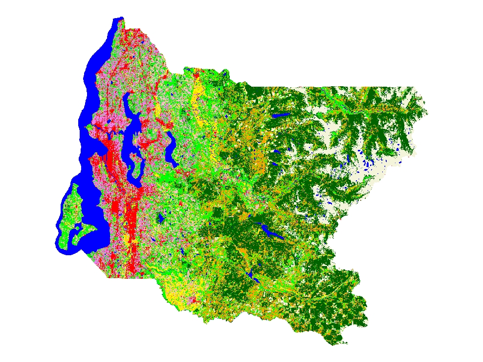
2007 Landcover Interpretation from Summer Imagery
Learn more by reading the GIS FAQ 🗺
Summary
To depict generalized landcover classes for June 2007
Description
A June 1, 2007 Landsat 5 TM image was classified into 11 general landcover classes.
The Landsat scene was clipped to a project area encompassing King County, Washington plus that portion of WRIA 8 that extends north into Snohomish County.
Layer information
| Layer Name | LANDCOVER_Landcover2007Landsat |
| Subject Category | Imagery |
| Title | 2007 Landcover Interpretation from Summer Imagery |
| Feature Count | 1 |
| Feature Type | Raster |
| Next Update | None planned |
| Spatial reference | None |
| Control ID | None |
| Place Keywords | Washington, King County |
| Theme Keywords | Landsat, Landcover, King County |
| Supplemental Information |
None |
Attribute information
|
ObjectID
From ESRI |
Description
Internal feature number. DomainSequential unique whole numbers that are automatically generated. |
|
Shape
From Esri |
Description
Feature geometry. DomainCoordinates defining the features. |
|
Shape_Length
From Esri |
Description
Length of feature in internal units. DomainPositive real numbers that are automatically generated. |
|
Shape_Area
From Esri |
Description
Area of feature in internal units squared. DomainPositive real numbers that are automatically generated. |
|
MosaicID
No Source Noted |
Description
Not Found DomainNot Found |
Contact information
| Maintained by | KCGIS Center |
| Primary |
KCGIS Center
giscenter@kingcounty.gov |
Terms of Use
| License | Terms of use and copyright |
Summary
To depict generalized landcover classes for June 2007
Description
A June 1, 2007 Landsat 5 TM image was classified into 11 general landcover classes.
The Landsat scene was clipped to a project area encompassing King County, Washington plus that portion of WRIA 8 that extends north into Snohomish County.
Contact information
| Maintained by | KCGIS Center |
| Primary |
KCGIS Center
giscenter@kingcounty.gov |
Terms of use and copyright
| License | Terms of use and copyright |
Change history
| 1/1/2008 |
Signature sites were collected in Imagine. A supervised classification was done using the siginatures. Upland areas mis-classified as High Intensity Development were reclassified as Bare Ground/Rock/Snow. Major roads were added as High Intensity Development. Large lakes were added as Water. An error matrix and accuracy report were created using the Imagine Accuracy Assessment tools. |