
GIS Data Catalog
2015 Impervious and Impacted Surface for Western King County Washington
Learn more by reading the GIS FAQ 🗺
Summary
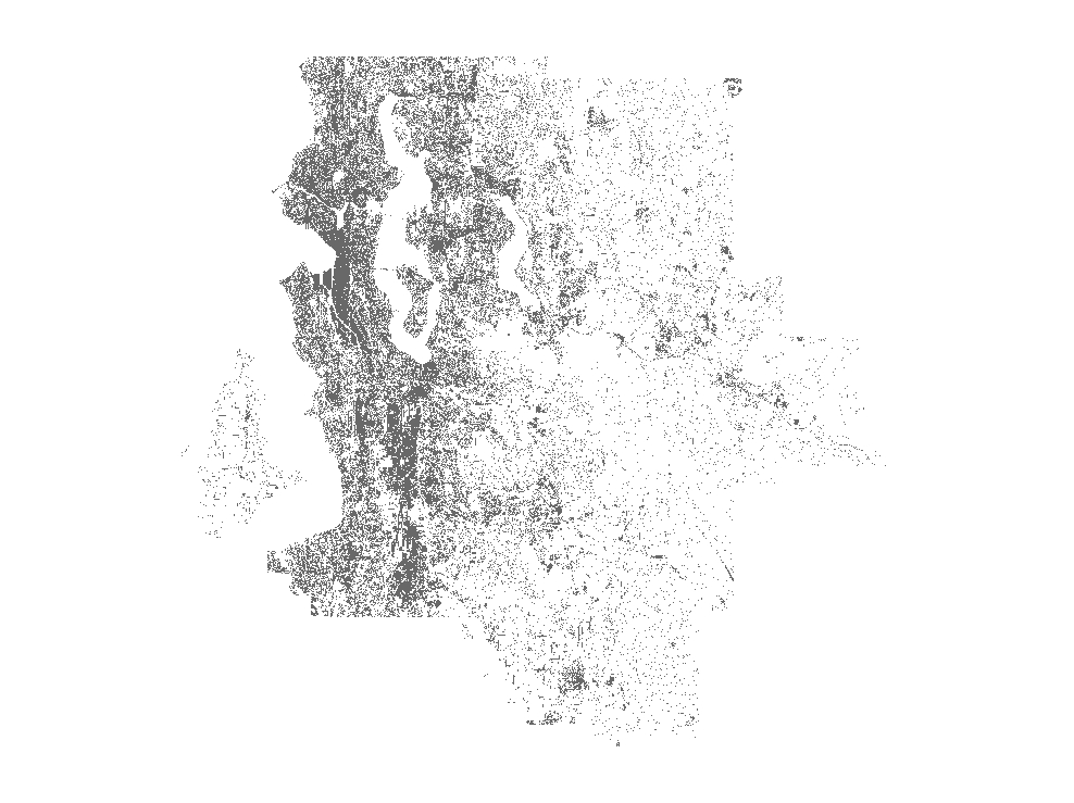
Provide a project-wide (King County and southwest Snohomish county) generalized interpretation of impervious and impacted surface current to 2015 for those areas completed.
By exclusion, null value areas imply vegetated or water.
Can to be used, within limitations of accuracy at suitable scales, to determine the distribution of these types of surfaces across the project area and to make first-order areal calculations.
Description
Year 2015 Impervious/Impacted Surface data, based primarily on spectral vegetative index applied to 2015 color infrared aerial orthoimagery.
Updated with ancillary vector sources.
Significant manual edits to remove commission error were applied.
Layer information
| Layer Name | LANDCOVER_Landcover2015Impervious |
| Subject Category | Imagery |
| Title | 2015 Impervious and Impacted Surface for Western King County Washington |
| Feature Count | 1 |
| Feature Type | Raster |
| Next Update | None planned |
| Spatial reference | None |
| Control ID | None |
| Place Keywords | Washington, King County |
| Theme Keywords | Impervious, Environment, Imagerybasemapsearthcover, Transportation |
| Supplemental Information |
Attribute information
|
OBJECTID
From Esri |
Description
Internal feature number. DomainSequential unique whole numbers that are automatically generated. |
|
SHAPE
From Esri |
Description
Feature geometry. DomainCoordinates defining the features. |
|
MosaicID
No Source Noted |
Description
Not Found DomainNot Found |
|
SHAPE_Length
From Esri |
Description
Length of feature in internal units. DomainPositive real numbers that are automatically generated. |
|
SHAPE_Area
From Esri |
Description
Area of feature in internal units squared. DomainPositive real numbers that are automatically generated. |
Contact information
| Maintained by | KCGIS Center |
| Primary |
KCGIS Center
giscenter@kingcounty.gov |
Terms of Use
| License | Terms of use and copyright |
Summary
Provide a project-wide (King County and southwest Snohomish county) generalized interpretation of impervious and impacted surface current to 2015 for those areas completed.
By exclusion, null value areas imply vegetated or water.
Can to be used, within limitations of accuracy at suitable scales, to determine the distribution of these types of surfaces across the project area and to make first-order areal calculations.
Description
Year 2015 Impervious/Impacted Surface data, based primarily on spectral vegetative index applied to 2015 color infrared aerial orthoimagery.
Updated with ancillary vector sources.
Significant manual edits to remove commission error were applied.
Contact information
| Maintained by | KCGIS Center |
| Primary |
KCGIS Center
giscenter@kingcounty.gov |
Terms of use and copyright
| License | Terms of use and copyright |
Change history
| 1/3/2017 |
1 Build Impervious layer from 4 band near infrared images. |