
GIS Data Catalog
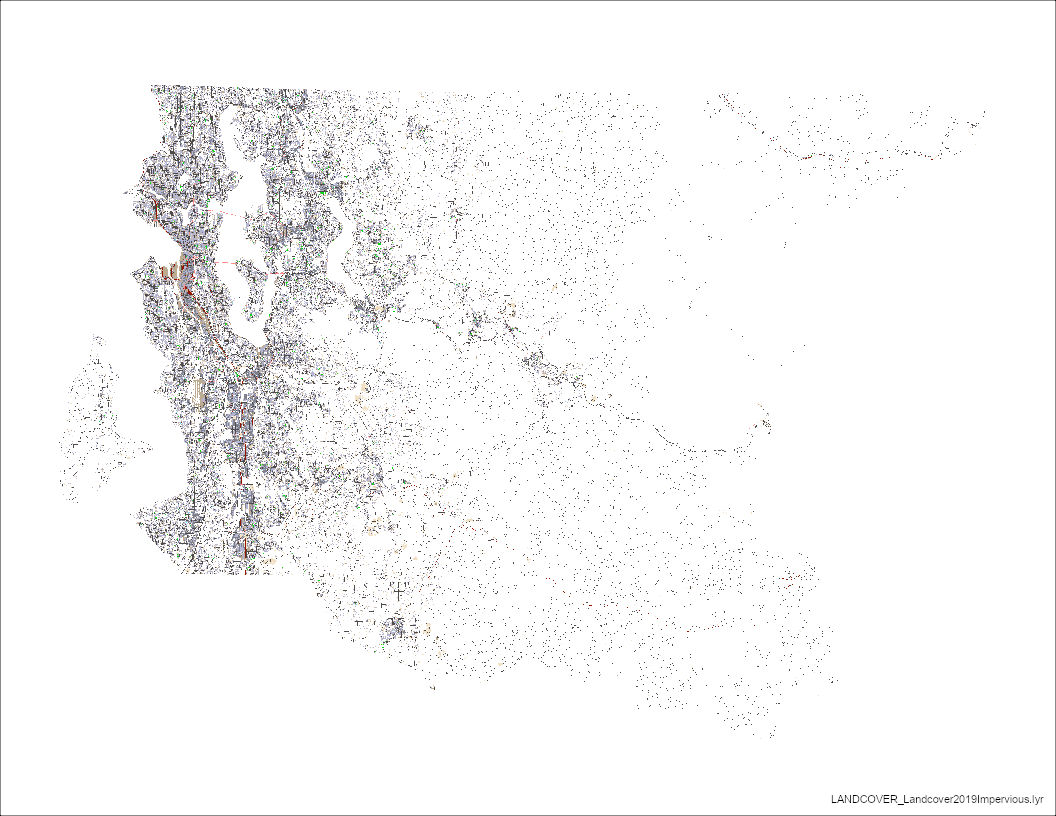
2019 Impervious and Impacted Surface of King County Washington
Learn more by reading the GIS FAQ 🗺
Summary
Provide a project-wide (King County and southwest Snohomish county) generalized interpretation of impervious and impacted surface current to 2019 for those areas completed.
By exclusion, null value areas imply vegetated or water.
Can to be used, within limitations of accuracy, to determine the distribution of these types of surfaces across the project area and to make first-order areal calculations.
Description
Year 2019 Impervious/Impacted Surface data updated with ancillary vector sources and interpreted, manual, updates from 2019 imagery.
See COMPLETENESS section in data quality for status of update progress.
Refer to metadata for IMPSURF_2000 for all other background information on original impervious surface development.
Layer information
| Layer Name | LANDCOVER_Landcover2019Impervious.lyr |
| Subject Category | Imagery |
| Title | 2019 Impervious and Impacted Surface of King County Washington |
| Feature Count | 1 |
| Feature Type | Raster |
| Next Update | As needed |
| Spatial reference | None |
| Control ID | None |
| Place Keywords | State Of Washington, Puget Sound Lowlands, United States, WA, Washington, Pacific Northwest, Pacific NW, Southwestern Snohomish County, King County, Western Cascade Mountains |
| Theme Keywords | Roads And Streets, Parking Lots, Manmade Surface, Impervious Surface, Non-Permeable Surface, Impacted Surface, Buildings, Concrete, Asphalt, Transportation |
| Supplemental Information | None |
Attribute information
|
OBJECTID
From ESRI |
Description
Internal feature number. DomainSequential unique whole numbers that are automatically generated. |
|
serial_id
No Source Noted |
Description
Not Found DomainNot Found |
|
Shape
From Esri |
Description
Feature geometry. DomainCoordinates defining the features. |
|
Shape_Length
From Esri |
Description
Length of feature in internal units. DomainPositive real numbers that are automatically generated. |
|
Shape_Area
From Esri |
Description
Area of feature in internal units squared. DomainPositive real numbers that are automatically generated. |
Contact information
| Maintained by | KCGIS Center |
| Primary |
KCGIS Center
giscenter@kingcounty.gov |
Terms of Use
| License | Terms of use and copyright |
Summary
Provide a project-wide (King County and southwest Snohomish county) generalized interpretation of impervious and impacted surface current to 2019 for those areas completed.
By exclusion, null value areas imply vegetated or water.
Can to be used, within limitations of accuracy, to determine the distribution of these types of surfaces across the project area and to make first-order areal calculations.
Description
Year 2019 Impervious/Impacted Surface data updated with ancillary vector sources and interpreted, manual, updates from 2019 imagery.
See COMPLETENESS section in data quality for status of update progress.
Refer to metadata for IMPSURF_2000 for all other background information on original impervious surface development.
Contact information
| Maintained by | KCGIS Center |
| Primary |
KCGIS Center
giscenter@kingcounty.gov |
Terms of use and copyright
| License | Terms of use and copyright |
Change history
| 8/3/2022 |
Field name value was added, joined to CateTile_Frq to calulate consistant values for each idxp7500 tile for consistancy in mosaic building: 1 bareland 2 bridge 3 building 4 driveway 5 parking 6 pavement 7 railway 8 road 9 sidewalk 10 sport_ground 11 swimming_pool 12 unpaved_sport_ground |
| 8/1/2022 |
2019 Ecopia vector layer from 2019 Pictometry Aerials was used for feature extraction of impervious values from CateTitle field: 1 bareland 2 bridge 3 building 4 driveway 5 parking 6 pavement 7 railway 8 road 9 sidewalk 10 sport_ground 11 swimming_pool 12 unpaved_sport_ground |
| 1/1/2010 |
CateTitle values: bareland, swimming pool, & unpaved sport ground were problematic and edited manually for acuracy. |