
GIS Data Catalog
NLCD 2016 Impervious Surface Conterminous United States
Learn more by reading the GIS FAQ 🗺
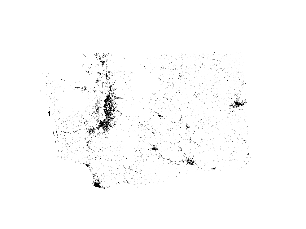
Summary
The goal of this project is to provide the Nation with complete, current and consistent public domain information on its land use and land cover.
Description
The U.S. Geological Survey (USGS), in partnership with several federal agencies, has developed and released four National Land Cover Database (NLCD) products over the past two decades: NLCD 1992, 2001, 2006, and 2011.
These products provide spatially explicit and reliable information on the Nation’s land cover and land cover change.
To continue the legacy of NLCD and further establish a long-term monitoring capability for the Nation’s land resources, the USGS has designed a new generation of NLCD products named NLCD 2016.
The NLCD 2016 design aims to provide innovative, consistent, and robust methodologies for production of a multi-temporal land cover and land cover change database from 2001 to 2016 at 2–3-year intervals.
Comprehensive research was conducted and resulted in developed strategies for NLCD 2016: a streamlined process for assembling and preprocessing Landsat imagery and geospatial ancillary datasets; a multi-source integrated training data development and decision-tree based land cover classifications; a temporally, spectrally, and spatially integrated land cover change analysis strategy; a hierarchical theme-based post-classification and integration protocol for generating land cover and change.
products; a continuous fields biophysical parameters modeling method; and an automated scripted operational system for the NLCD 2016 production.
The performance of the developed strategies and methods were tested in twenty World Reference System-2 path/row throughout the conterminous U.S. An overall agreement ranging from 71% to 97% between land cover classification and reference data was achieved for all tested area and all years.
Results from this study confirm the robustness of this comprehensive and highly automated procedure for NLCD 2016 operational mapping.
Questions about the NLCD 2016 land cover product can be directed to the NLCD 2016 land cover mapping team at USGS EROS, Sioux Falls, SD (605) 594-6151 or mrlc@usgs.gov.
See included spatial metadata for more details.
Layer information
| Layer Name | LANDCOVER_NLCDImpervious2016WA |
| Subject Category | Imagery |
| Title | NLCD 2016 Impervious Surface Conterminous United States |
| Feature Count | 1 |
| Feature Type | Raster |
| Spatial reference | None |
| Control ID | None |
| Place Keywords | None |
| Theme Keywords | Digital Spatial Data, Land Cover, U.S. Geological Survey (USGS), GIS, Image Processing, National Geospatial Data Asset, Land Use Land Cover Theme, NGDA, US, U.S., United States, 010, Imagerybasemapearthcover, Imagerybasemapsearthcover |
| Supplemental Information |
Corner Coordinates (center of pixel, projection meters) Upper Left Corner: -2493045 meters(X), 3310005 meters(Y) Lower Right Corner: -177285 meters(X), 2342655 meters(Y) |
Attribute information
|
ObjectID
From ESRI |
Description
Internal feature number DomainSequential unique whole numbers that are automatically generated. |
|
SHAPE
From Esri |
Description
Feature geometry. DomainCoordinates defining the features. |
|
MosaicID
No Source Noted |
Description
Not Found DomainNot Found |
|
SHAPE_Length
From Esri |
Description
Length of feature in internal units. DomainPositive real numbers that are automatically generated. |
|
SHAPE_Area
From Esri |
Description
Area of feature in internal units squared. DomainPositive real numbers that are automatically generated. |
Contact information
| Maintained by | KCGIS Center |
| Primary |
KCGIS Center
giscenter@kingcounty.gov |
Terms of Use
| License | Terms of use and copyright |
Summary
The goal of this project is to provide the Nation with complete, current and consistent public domain information on its land use and land cover.
Description
The U.S. Geological Survey (USGS), in partnership with several federal agencies, has developed and released four National Land Cover Database (NLCD) products over the past two decades: NLCD 1992, 2001, 2006, and 2011.
These products provide spatially explicit and reliable information on the Nation’s land cover and land cover change.
To continue the legacy of NLCD and further establish a long-term monitoring capability for the Nation’s land resources, the USGS has designed a new generation of NLCD products named NLCD 2016.
The NLCD 2016 design aims to provide innovative, consistent, and robust methodologies for production of a multi-temporal land cover and land cover change database from 2001 to 2016 at 2–3-year intervals.
Comprehensive research was conducted and resulted in developed strategies for NLCD 2016: a streamlined process for assembling and preprocessing Landsat imagery and geospatial ancillary datasets; a multi-source integrated training data development and decision-tree based land cover classifications; a temporally, spectrally, and spatially integrated land cover change analysis strategy; a hierarchical theme-based post-classification and integration protocol for generating land cover and change.
products; a continuous fields biophysical parameters modeling method; and an automated scripted operational system for the NLCD 2016 production.
The performance of the developed strategies and methods were tested in twenty World Reference System-2 path/row throughout the conterminous U.S. An overall agreement ranging from 71% to 97% between land cover classification and reference data was achieved for all tested area and all years.
Results from this study confirm the robustness of this comprehensive and highly automated procedure for NLCD 2016 operational mapping.
Questions about the NLCD 2016 land cover product can be directed to the NLCD 2016 land cover mapping team at USGS EROS, Sioux Falls, SD (605) 594-6151 or mrlc@usgs.gov.
See included spatial metadata for more details.
Contact information
| Maintained by | KCGIS Center |
| Primary |
KCGIS Center
giscenter@kingcounty.gov |
Terms of use and copyright
| License | Terms of use and copyright |
Change history
| 1/1/2016 |
Defense Meteorological Satellite Program (DMSP) Nighttime Lights and Visible Infrared Imaging Radiometer Suite (VIIRS) Day/Night band Nighttime Lights have been applied by many researchers as a way to study such topics as population density and economic activity. These two datasets are used in the generation of training data for the new NLCD 2016 Impervious Surface for 2011 and 2016, respectively. DMSP Nighttime Lights (for 2011) and VIIRS Day/Night band Nighttime Lights (for 2016) were superimposed on NLCD 2011 Impervious Surface data to exclude low density impervious areas outside urban and suburban centers, and ensure that only core urban areas were included in training data development. Two training datasets, one of larger extent, one smaller, were assembled by imposing two separate thresholds of nighttime lights imagery onto the NLCD 2011 Impervious Surface data layer. Each of the two training datasets were used separately to build regression tree models for predicting percent impervious surface using 2011 Landsat imagery as predictive variables. These two sets of regression tree models were the basis of two 2011 initial impervious surface maps. The same two training datasets were used with 2016 Landsat imagery to create two sets of regression tree models and two 2016 initial impervious surface maps. The two pairs of initial impervious surface maps - 2 each for 2011 and 2016 - were compared to remove false estimates caused by high reflectance in non-urban areas, as well as to retain 2011 impervious values unchanged from 2011 to 2016. An updated 2016 impervious surface map was generated. The last step is a clean-up to correct mapping errors with automated processes and some hand editing. For example, false impervious estimates in mines and barren land were removed, and developed areas with low imperviousness, such as city parks and golf courses, were added. |