
GIS Data Catalog
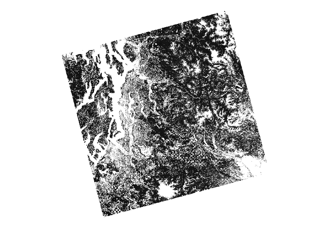
2001 National Land Cover Database Zone 01 Tree Canopy Layer
Learn more by reading the GIS FAQ 🗺
Summary
The goal of this project is to provide the Nation with complete, current and consistent public domain information on its land use and land cover.
Description
The National Land Cover Database 2001 tree canopy layer for mapping zone 01 was produced through a cooperative project conducted by the Multi-Resolution Land Characteristics (MRLC) Consortium.
The MRLC Consortium is a partnership of federal agencies (www.mrlc.gov), consisting of the U.S. Geological Survey (USGS), the National Oceanic and Atmospheric Administration (NOAA), the U.S. Environmental Protection Agency (EPA), the U.S. Department of Agriculture (USDA), the U.S. Forest Service (USFS), the National Park Service (NPS), the U.S. Fish and Wildlife Service (FWS), the Bureau of Land Management (BLM) and the USDA Natural Resources Conservation Service (NRCS).
One of the primary goals of the project is to generate a current, consistent, seamless, and accurate National Land cover Database (NLCD) circa 2001 for the United States at medium spatial resolution.
For a detailed definition and discussion on MRLC and the NLCD 2001 products, refer to Homer et al.
(2003) and https://www.mrlc.gov/mrlc2k.asp.The NLCD 2001 was created by partitioning the U.S. into mapping zones.
A total of 66 mapping zones were delineated within the conterminous U.S. based on ecoregion and geographical characteristics, edge matching features and the size requirement of Landsat mosaics.
Mapping zone 01 encompasses the western portion of Washington state .
Questions about the NLCD mapping zone 01 can be directed to the NLCD 2001 land cover mapping team at the National Center, EROS, Sioux Falls, SD (605) 594-6151 or mrlc@usgs.gov.
Layer information
| Layer Name | LANDCOVER_NationalLandcoverDB2001TreeCanopyPercent |
| Subject Category | Imagery |
| Title | 2001 National Land Cover Database Zone 01 Tree Canopy Layer |
| Feature Count | 1 |
| Feature Type | Raster |
| Next Update | As needed |
| Spatial reference | None |
| Control ID | None |
| Place Keywords | Zone 01 |
| Theme Keywords | Imagery, Base Maps, Earth Cover, USGS, Tree Canopy, Digital Spatial Data, GIS, U.S. Geological Survey |
| Supplemental Information |
Corner Coordinates (center of pixel, projection meters)Upper Left Corner: -2154300 meters(X), 3183760 meters(Y)Lower Right Corner: -1730730 meters(X), 2774050 meters(Y)Spatial-specific information not available |
Attribute information
|
ObjectID
From ESRI |
Description
Internal feature number DomainSequential unique whole numbers that are automatically generated. |
|
Shape
From Esri |
Description
Feature geometry. DomainCoordinates defining the features. |
|
Shape_Length
From Esri |
Description
Length of feature in internal units. DomainPositive real numbers that are automatically generated. |
|
Shape_Area
From Esri |
Description
Area of feature in internal units squared. DomainPositive real numbers that are automatically generated. |
|
MosaicID
No Source Noted |
Description
Not Found DomainNot Found |
Contact information
| Maintained by | KCGIS Center |
| Primary |
KCGIS Center
giscenter@kingcounty.gov |
Terms of Use
| License | Terms of use and copyright |
Summary
The goal of this project is to provide the Nation with complete, current and consistent public domain information on its land use and land cover.
Description
The National Land Cover Database 2001 tree canopy layer for mapping zone 01 was produced through a cooperative project conducted by the Multi-Resolution Land Characteristics (MRLC) Consortium.
The MRLC Consortium is a partnership of federal agencies (www.mrlc.gov), consisting of the U.S. Geological Survey (USGS), the National Oceanic and Atmospheric Administration (NOAA), the U.S. Environmental Protection Agency (EPA), the U.S. Department of Agriculture (USDA), the U.S. Forest Service (USFS), the National Park Service (NPS), the U.S. Fish and Wildlife Service (FWS), the Bureau of Land Management (BLM) and the USDA Natural Resources Conservation Service (NRCS).
One of the primary goals of the project is to generate a current, consistent, seamless, and accurate National Land cover Database (NLCD) circa 2001 for the United States at medium spatial resolution.
For a detailed definition and discussion on MRLC and the NLCD 2001 products, refer to Homer et al.
(2003) and https://www.mrlc.gov/mrlc2k.asp.The NLCD 2001 was created by partitioning the U.S. into mapping zones.
A total of 66 mapping zones were delineated within the conterminous U.S. based on ecoregion and geographical characteristics, edge matching features and the size requirement of Landsat mosaics.
Mapping zone 01 encompasses the western portion of Washington state .
Questions about the NLCD mapping zone 01 can be directed to the NLCD 2001 land cover mapping team at the National Center, EROS, Sioux Falls, SD (605) 594-6151 or mrlc@usgs.gov.
Contact information
| Maintained by | KCGIS Center |
| Primary |
KCGIS Center
giscenter@kingcounty.gov |
Terms of use and copyright
| License | Terms of use and copyright |
Change history
| unknown |
To develop adequate training data for tree canopy density estimation, 19 1-m resolution DOQQs across mapping zone 01 were classified into either tree canopy or non-tree canopy areas, and then values summed within each 30 meter Landsat pixel cell to obtain the percentage of tree canopy. The training data were selected based on the degree of variance each training data set possesses with regards to Landsat ETM+ imagery used for mapping. Each added training data set decreased the amount of variance present within the Landsat data as a whole. The process was repeated until the required number of samples 70,192 had been allocated.By combining the training data with Landsat spectral data and other ancillary data, tree canopy prediction models were developed using "Cubist". After the best combination of possible input data layers had been determined and the final percent canopy density layer produced, a mask was made from the final land cover classification of the mapping zone and was used to eliminate those pixels from the canopy density file that fall into non-forested areas. The mask includes 5 land cover classes (deciduous forest, coniferous forest, mixed forest, woody wetlands, and developed open space).Acquisition dates of Landsat ETM+ (TM) scenes used for land cover classification in this zone are as follows:SPRING-Index 1 for Path 45/Row 26 on 03/21/01 = Scene_ID 5045026000108010Index 2 for Path 45/Row 27 on 03/26/00 = Scene_ID 7045027000008650Index 1 for Path 45/Row 28 on 03/21/01 = Scene_ID 5045028000108010Index 3 for Path 46/Row 26 on 05/07/01 = Scene_ID 7046026000112750Index 4 for Path 46/Row 27 on 05/31/01 = Scene_ID 5046027000115110Index 5 for Path 46/Row 28 on 04/10/00 = Scene_ID 5046028000010110Index 6 for Path 47/Row 26 on 02/13/00 = Scene_ID 5047026000004410Index 7 for Path 47/Row 27 on 02/26/02 = Scene_ID 7047027000205750Index 7 for Path 47/Row 28 on 02/26/02 = Scene_ID 7047028000205750Index 8 for Path 48/Row 26 on 04/03/01 = Scene_ID 7048026000109350Index 8 for Path 48/Row 27 on 04/03/01 = Scene_ID 7048027000109350LEAF ON (Summer)-Index 1 for Path 45/Row 26 on 07/16/00 = Scene_ID 7045026000019850Index 2 for Path 45/Row 27 on 07/22/02 = Scene_ID 7045027000220350Index 1 for Path 45/Row 28 on 07/16/00 = Scene_ID 7045028000019850Index 3 for Path 46/Row 26 on 08/11/01 = Scene_ID 7046026000122350Index 4 for Path 46/Row 27 on 07/07/00 = Scene_ID 7046027000018950Index 4 for Path 46/Row 28 on 07/07/00 = Scene_ID 7046028000018950Index 5 for Path 47/Row 26 on 07/30/00 = Scene_ID 7047026000021250Index 5 for Path 47/Row 27 on 07/30/00 = Scene_ID 7047027000021250Index 6 for Path 47/Row 28 on 07/01/01 = Scene_ID 7047028000118250Index 7 for Path 48/Row 26 on 07/21/00 = Scene_ID 7048026000020350Index 8 for Path 48/Row 27 on 06/03/00 = Scene_ID 7048027000015550LEAF-OFF (Fall)-Index 1 for Path 45/Row 26 on 10/18/99 = Scene_ID 7045026009929150Index 2 for Path 45/Row 27 on 10/04/00 = Scene_ID 7045027000027850Index 3 for Path 45/Row 28 on 08/17/00 = Scene_ID 7045028000023050Index 4 for Path 46/Row 26 on 09/12/01 = Scene_ID 7046026000125550Index 5 for Path 46/Row 27 on 09/25/00 = Scene_ID 7046027000026950Index 5 for Path 46/Row 28 on 09/25/00 = Scene_ID 7046028000026950Index 6 for Path 47/Row 26 on 10/05/01 = Scene_ID 7047026000127850Index 7 for Path 47/Row 27 on 11/01/99 = Scene_ID 7047027009930550Index 8 for Path 47/Row 28 on 10/16/99 = Scene_ID 7047028009928950Index 9 for Path 48/Row 26 on 09/23/00 = Scene_ID 7048026000026750Index 9 for Path 48/Row 27 on 09/23/00 = Scene_ID 7048027000026750Landsat data and ancillary data used for the tree canopy -Data Type of DEM composed of 1 band of Continuous Variable Type.Data Type of Slope composed of 1 band of Continuous Variable Type.Data Type of Aspect composed of 1 band of Categorical Variable Type.Data type of Position Index composed of 1 band of Continuous Variable Type. |
| unknown |
The method employed to map tree canopy density for NLCD 2001 consists of three key steps: deriving reference data of tree canopy density from the high spatial resolution images, calibrating density prediction models using reference data and Landsat spectral bands, and extrapolating the developed models spatially to map per-pixel tree canopy density. This method is described in detail in Huang et al. (2001). This approach was applied to mapping zone 01 by Space Imaging. |