
GIS Data Catalog
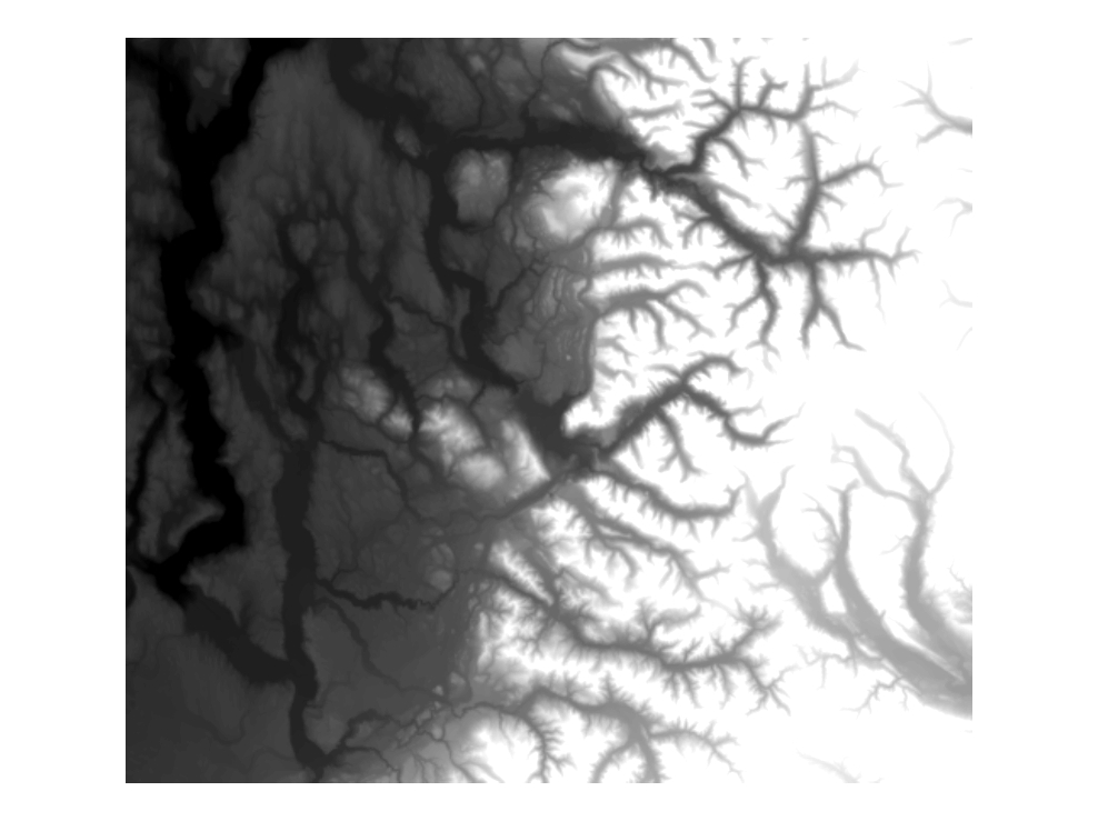
2021 LiDAR Digital Ground Model (DGM) Elevation and Hillshade
Learn more by reading the GIS FAQ 🗺
Summary
Comparable in purpose and use to the USGS Digital Elevation Model (DEM) data but generally of a higher level of accuracy and sample density.
Useful for a range of analytical and cartographic projects including flood hazard evaluation, geologic mapping, hydrologic modeling, slope and aspect determination, and line-of-sight calculations.
These data was processed through an extensive series of quality control steps by both the vendors and clients; however, they are still considered an interpretation or model of the earth's surface rather than an absolute point-to-point measure.
Further, the data are not without error due to incomplete editing, absence of sufficient point density, and other 'blunder' or erroneous points.
Finally, due to changing ground and vegetative conditions the quality and accuracy of the data vary considerably with areas of steep relief and/or dense vegetation exhibiting poorer quality than open flat areas.
This is due to a large variance in the number of points from area to area that are considered 'to-ground' values combined with the variance in absolute horizontal and positional accuracy of given points.
Users must make careful review of the fitness of these data for their particular use.
For many purposes a site- and use-specific field survey will be necessary.
In particular, derivation of contours, whether from the raw ascii points or a derived surface (i.e., lattice or tin), should be approached with caution due to the high variability of the data.
Contours generated at an interval finer than 5-feet may not meet necessary accuracy requirements for specific environmental or building purposes needs and do not take the place of a first-order ground survey.
Description
Last-return LiDAR data edited to remove 90-95% of vegetated and man-made elevated features.
Depicts - within limits of operational accuracy, point density and editing efficiencies - a 'bare-earth' interpretation of the earth's Also called Digital Ground Model (DGM), Virtually-Deforested (VDF) Model, or 'Mowed' Data is stored as ArcInfo Lattice Grids.
Layer information
| Layer Name | SURFACE_LiDARDigitalGroundModelElevation_2021_update |
| Subject Category | Imagery |
| Title | 2021 LiDAR Digital Ground Model (DGM) Elevation and Hillshade |
| Feature Count | 1 |
| Feature Type | Raster |
| Next Update | As needed |
| Spatial reference | None |
| Control ID | None |
| Place Keywords | King County, Seattle, Washington State, Pacific NW, WA |
| Theme Keywords | Lidar Digital Elevation Data, Digital Ground Model (DGM), Topography, Bare-Earth, Elevation Data, Virtually Deforested, Elevation |
| Supplemental Information |
Project tracking is maintained in this metadata and also in the DGM_SOURCE_AREA layer available from the King County GIS data portal. |
Attribute information
|
OBJECTID
From Esri |
Description
Internal feature number. DomainSequential unique whole numbers that are automatically generated. |
|
SHAPE
From Esri |
Description
Feature geometry. DomainCoordinates defining the features. |
|
MosaicID
No Source Noted |
Description
Not Found DomainNot Found |
|
SHAPE_Length
From Esri |
Description
Length of feature in internal units. DomainPositive real numbers that are automatically generated. |
|
SHAPE_Area
From Esri |
Description
Area of feature in internal units squared. DomainPositive real numbers that are automatically generated. |
Contact information
| Maintained by | KCGIS Center |
| Primary |
KCGIS Center
giscenter@kingcounty.gov |
Terms of Use
| License | Terms of use and copyright |
Summary
Comparable in purpose and use to the USGS Digital Elevation Model (DEM) data but generally of a higher level of accuracy and sample density.
Useful for a range of analytical and cartographic projects including flood hazard evaluation, geologic mapping, hydrologic modeling, slope and aspect determination, and line-of-sight calculations.
These data was processed through an extensive series of quality control steps by both the vendors and clients; however, they are still considered an interpretation or model of the earth's surface rather than an absolute point-to-point measure.
Further, the data are not without error due to incomplete editing, absence of sufficient point density, and other 'blunder' or erroneous points.
Finally, due to changing ground and vegetative conditions the quality and accuracy of the data vary considerably with areas of steep relief and/or dense vegetation exhibiting poorer quality than open flat areas.
This is due to a large variance in the number of points from area to area that are considered 'to-ground' values combined with the variance in absolute horizontal and positional accuracy of given points.
Users must make careful review of the fitness of these data for their particular use.
For many purposes a site- and use-specific field survey will be necessary.
In particular, derivation of contours, whether from the raw ascii points or a derived surface (i.e., lattice or tin), should be approached with caution due to the high variability of the data.
Contours generated at an interval finer than 5-feet may not meet necessary accuracy requirements for specific environmental or building purposes needs and do not take the place of a first-order ground survey.
Description
Last-return LiDAR data edited to remove 90-95% of vegetated and man-made elevated features.
Depicts - within limits of operational accuracy, point density and editing efficiencies - a 'bare-earth' interpretation of the earth's Also called Digital Ground Model (DGM), Virtually-Deforested (VDF) Model, or 'Mowed' Data is stored as ArcInfo Lattice Grids.
Contact information
| Maintained by | KCGIS Center |
| Primary |
KCGIS Center
giscenter@kingcounty.gov |
Terms of use and copyright
| License | Terms of use and copyright |