
GIS Data Catalog
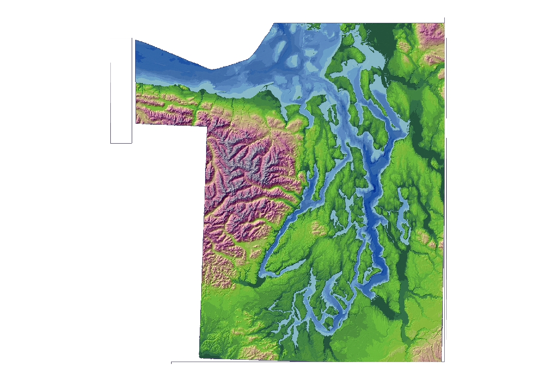
Color scale hillshade from regional Puget Sound - land and bathymetry
Learn more by reading the GIS FAQ 🗺
Summary
Generalized cartographic display
Description
Color scale hillshade derived from PSDEM2005 source data.
Layer information
| Layer Name | SURFACE_PSDEMColorHillshadeCartographic |
| Subject Category | Imagery |
| Title | Color scale hillshade from regional Puget Sound - land and bathymetry |
| Feature Count | 1 |
| Feature Type | Raster |
| Next Update | None planned |
| Spatial reference | None |
| Control ID | None |
| Place Keywords | Pacific NW, Puget Sound Lowlands, Washington State |
| Theme Keywords | Elevation, Elevation Model, Digital Elevation Model, Hillshade, Topography |
| Supplemental Information |
All these datasets exist only at KeyRegion index level. |
Attribute information
|
OBJECTID
From ESRI |
Description
Internal feature number. DomainSequential unique whole numbers that are automatically generated. |
|
Shape
From ESRI |
Description
Feature geometry. DomainCoordinates defining the features. |
|
Shape_Length
From Esri |
Description
Length of feature in internal units. DomainPositive real numbers that are automatically generated. |
|
Shape_Area
From Esri |
Description
Area of feature in internal units squared. DomainPositive real numbers that are automatically generated. |
|
MosaicID
No Source Noted |
Description
Not Found DomainNot Found |
Contact information
| Maintained by | KCGIS Center |
| Primary |
KCGIS Center
giscenter@kingcounty.gov |
Terms of Use
| License | Terms of use and copyright |
Summary
Generalized cartographic display
Description
Color scale hillshade derived from PSDEM2005 source data.
Contact information
| Maintained by | KCGIS Center |
| Primary |
KCGIS Center
giscenter@kingcounty.gov |
Terms of use and copyright
| License | Terms of use and copyright |
Change history
| 12/1/2005 |
Zoom to each rectangle in psgrid and export the image in tif format with world file at 221 dpi to produce an image at the original resolution of 30 feet. Export 154 images to cover map exent of reg_psdem030. |
| 12/1/2005 |
Add reg_psdem030 grid to Arcmap 9.0 Project. Reclass the reg_psdem display using Gisdw\kclib\plibrary3\keyregion\Elevation\elevationcolorramp.lyr Add reg_pshsd030.sid to Arcmap project and set display transparency to %50. |
| 12/1/2005 |
Mosaic the 154 tiff images into one reg_pschs030.sid. Use MrSID GeoExpress v. 5 to convert TIFF to SID for posting to Spatial Data Warehouse. Image was compressed at approximately 7x. |
| 12/1/2005 |
Build index cover psgrid using ArcInfo 9.0 command generate\fishnet to cover reg_psdem030 map extent. Origin at 1358000, 2200. X width at 47520 feet and Y height at 31680 feet. Add to Arcmap 9.0 project. |