
GIS Data Catalog
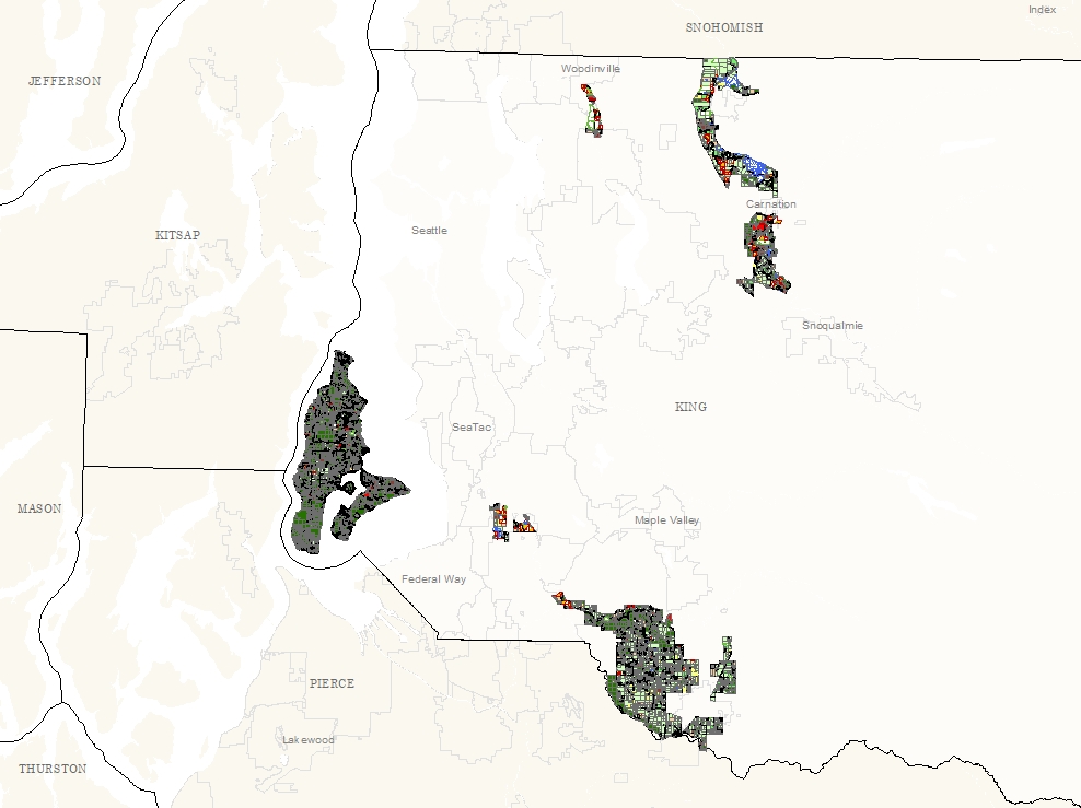
Agricultural Land Use 2006 for Ag. Production Districts and Vashon
Learn how to get an ArcGIS Online account 🗺
Use this Data
|
Links
How to use in ArcGIS Pro |
|
| Sharing Status | Not Public |
Summary
To assess activity and land use particularly within the agricultural designated areas.
Description
Agricultural Land Uses within the Agricultural Production Districts and on Vashon-Maury Island.
Land Uses identified through windshield survey and confirmed with aerial photography.
Layer information
| Layer Name | ag_landuse06_area |
| Subject Category | Natural Resources |
| Title | Agricultural Land Use 2006 for Ag. Production Districts and Vashon |
| Feature Count | 14875 |
| Feature Type | Polygon |
| Next Update | None planned |
| Spatial reference | EPSG:2926 |
| Control ID | 497 |
| Place Keywords | Pacific NW, Washington State, King County, WA, Vashon-Maury Island, Agricultural Production Districts |
| Theme Keywords | Agriculture, Natural Resources, Land Use, Environmental, Natres, Environment, Farming |
| Supplemental Information |
None |
Attribute information
|
LU_CODE
From King County Ag. Staff |
Description
Land Use Code DomainUnique values to identify land uses such as 1a |
|
LU_DESCRIP
From King County Ag. Staff |
Description
Land Use Description Domain(no value) - pending coding Corn - Corn Forested, Upland - Forested, Upland Grapes - Grapes Livestock, Forage - Livestock, Forage Managed Field, Grassland - Managed, non-productive field or grassland Market Crops (Produce) - Market Crops (Produce) Nursery - Nursery Orchard - Orchard Other (roads, buildings, water bodies, buffers, etc.) - Other (roads, buildings, water bodies, buffers, etc.) Sports, Recreational - Sports, Recreational Topsoil Production - Topsoil Production Tree Farm - Tree Farm Unknown - Not visible from road Unmanaged - Grassland, ungrazed or uncut Unmanaged Orchard - Unmanaged Orchard |
|
PIN
From Parcel Database |
Description
Parcel Identification Number Domain10 digit parcel identifier |
|
OBJECTID
From ESRI |
Description
Internal feature number. DomainSequential unique whole numbers that are automatically generated. |
|
SHAPE
From ESRI |
Description
Feature geometry. DomainCoordinates defining the features. |
|
ACRES
From ESRI |
Description
GIS Acres DomainAcres |
|
Shape.STArea()
From SQL Server |
Description
Returns the area of a geometry instance in square units, based on the spatial reference identifier (SRID) of the geometry. DomainDouble |
|
Shape.STLength()
From SQL Server |
Description
Returns the total length of the elements in a geometry instance. DomainDouble |
Contact information
| Maintained by | DNRP - Water and Land Resources |
| Primary |
Harkeerat Kang
Harkeerat.Kang@kingcounty.gov |
Terms of Use
| License | Terms of use and copyright |
Use this Data
|
Links
How to use in ArcGIS Pro |
|
| Sharing Status | Not Public |
Summary
To assess activity and land use particularly within the agricultural designated areas.
Description
Agricultural Land Uses within the Agricultural Production Districts and on Vashon-Maury Island.
Land Uses identified through windshield survey and confirmed with aerial photography.
Contact information
| Maintained by | DNRP - Water and Land Resources |
| Primary |
Harkeerat Kang
Harkeerat.Kang@kingcounty.gov |
Terms of use and copyright
| License | Terms of use and copyright |
Change history
| 11/1/2006 |
A subset of the King County parcel layer was extracted. Each parcel was coded with land uses, and split if there were multiple land uses. Aerial photos were referenced for confirmation. |
| 7/1/2006 |
1. King County ag. staff developed land use categories, based on 2001 ag. land use survey. 2. Field work was annotated on aerial photos through windshield survey. |