
GIS Data Catalog
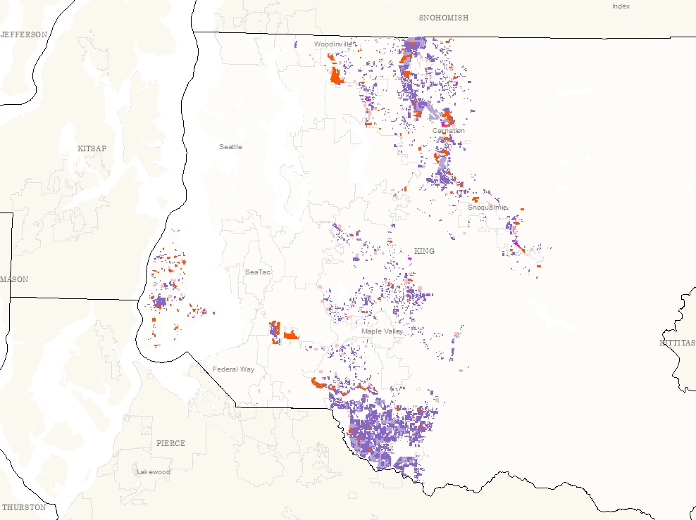
2003 Generalized Agricultural Land Use
Learn how to get an ArcGIS Online account 🗺
Use this Data
|
Links
How to use in ArcGIS Pro |
|
| Sharing Status | Not Public |
Summary
To assess agricultural activity and land use.
Description
Generalized Agricultural Land Uses within the Agricultural Production Districts and in rural areas outside the Agricultural Production Districts.
Land Uses identified through windshield survey and confirmed with aerial photography.
Layer information
| Layer Name | ag_landuse_genl03_area |
| Subject Category | Natural Resources |
| Title | 2003 Generalized Agricultural Land Use |
| Feature Count | 7165 |
| Feature Type | Polygon |
| Next Update | None planned |
| Spatial reference | None |
| Control ID | 499 |
| Place Keywords | Pacific NW, King County, WA, Washington State |
| Theme Keywords | Natural Resources, Land Use, Agriculture, Natres, Farming |
| Supplemental Information |
None |
Attribute information
|
PIN
From King County |
Description
Parcel Identification Number DomainCoordinates defining the features |
|
ACRES
From King County |
Description
Acres calculated by GIS Domain0.002 to 221.719 by |
|
LU_CODE
From King County |
Description
Single Character Land Use Code DomainD - Dairies H - Horticultural Properties L - Livestock Properties M - Multiple (Hort. and Livestock) U - Unspecified Agriculture |
|
CAT_APD
From King County |
Description
Combined field of Land Use Category with APD DomainValue from fields Category and APD |
|
LU_DESCRIP
From King County |
Description
Land Use Description DomainText description of land use category |
|
OBJECTID
From ESRI |
Description
Internal feature number. DomainSequential unique whole numbers that are automatically generated. |
|
APD
From King County |
Description
Whether or not it's in the Agricultural Production District DomainN - No Y - Yes |
|
SHAPE
From ESRI |
Description
Feature geometry. DomainCoordinates defining the features. |
|
Shape.STArea()
From SQL Server |
Description
Returns the area of a geometry instance in square units, based on the spatial reference identifier (SRID) of the geometry. DomainDouble |
|
Shape.STLength()
From SQL Server |
Description
Returns the total length of the elements in a geometry instance. DomainDouble |
Contact information
| Maintained by | DNRP - Water and Land Resources |
| Primary |
Harkeerat Kang
Harkeerat.Kang@kingcounty.gov |
Terms of Use
| License | Terms of use and copyright |
Use this Data
|
Links
How to use in ArcGIS Pro |
|
| Sharing Status | Not Public |
Summary
To assess agricultural activity and land use.
Description
Generalized Agricultural Land Uses within the Agricultural Production Districts and in rural areas outside the Agricultural Production Districts.
Land Uses identified through windshield survey and confirmed with aerial photography.
Contact information
| Maintained by | DNRP - Water and Land Resources |
| Primary |
Harkeerat Kang
Harkeerat.Kang@kingcounty.gov |
Terms of use and copyright
| License | Terms of use and copyright |
Change history
| 4/1/2003 |
The 2001 land use survey categories were generalized into 5 categories. These were merged with the 2003 windshield survey parcels outside the APD's. |
| 1/1/2003 |
King County parcel layer was used as a base for coding agricultural land uses, from field survey notes. |
| 10/1/2002 |
King County ag. staff developed land use categories for generalized land use outside APD's. Field work was annotated on aerial photos through windshield survey. |