
GIS Data Catalog
Agricultural Waterway Classification
Learn how to get an ArcGIS Online account 🗺
Use this Data
|
Links
How to use in ArcGIS Pro |
|
| Sharing Status | Not Public |
Summary
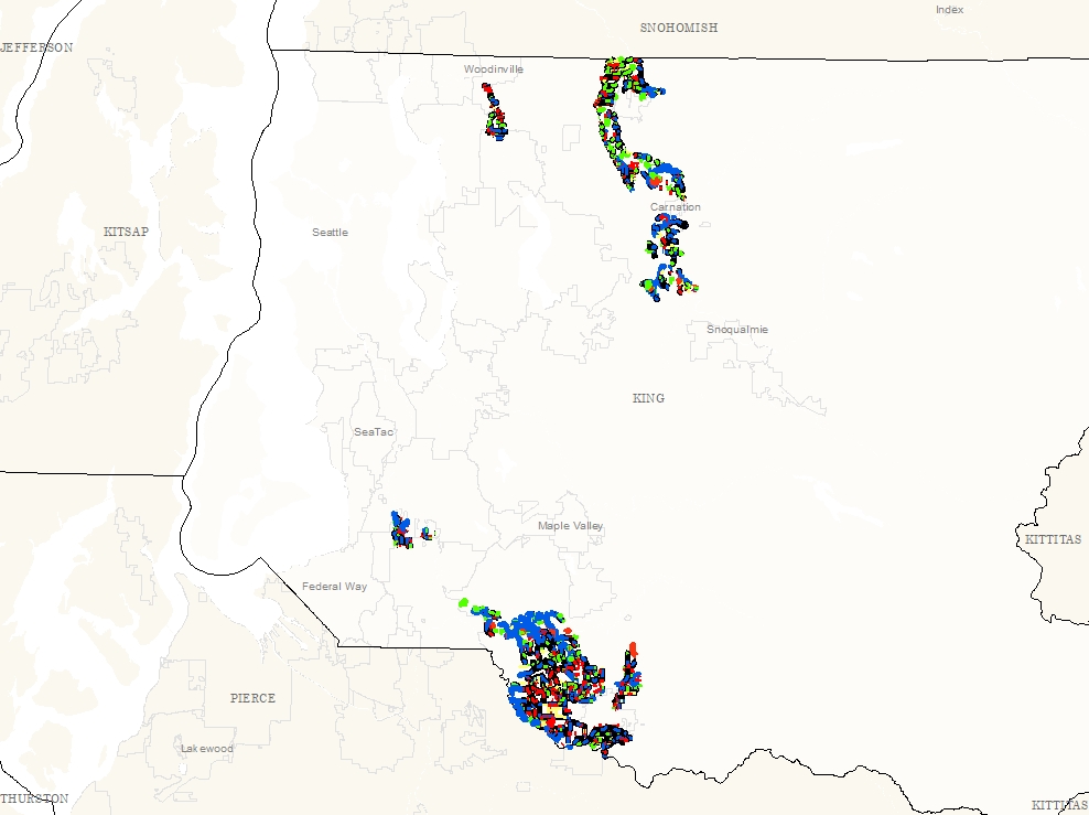
A classification of waterways in order to guide decisions on allocation of best management practices for fish protection and restoration of fish habitat and water
quality during agricultural waterway maintenance dredging.
To rate potential level of juvenile salmon use at time of maintenance, the classification applies local, credible knowledge of salmon abundance or density, water flow and temperature, or, where such knowledge is lacking, King County Geographic Information System (GIS) data to predict the potential for high, moderate, or low levels of salmon use in a given Agricultural Production District (APD) waterway.
.
Description
Waterway Classification within Agricultural Production Districts developed as a resource for the Agricultural Drainage Assistance Program (ADAP) .The first component of the classification is whether the waterway is a natural stream, a modified stream, or an artificial ditch.
The second component describes the expected presence or level of abundance of juvenile salmonids during the standard construction window.
Layer information
| Layer Name | ag_wways_class_line |
| Subject Category | Hydrography |
| Title | Agricultural Waterway Classification |
| Feature Count | 1558 |
| Feature Type | Line |
| Next Update | As needed |
| Spatial reference | None |
| Control ID | 2745 |
| Place Keywords | Pacific NW, King County, WA, Washington State |
| Theme Keywords | Hydro, Salmonids, Agriculture, Drainage, Farming, Biota, Environment |
| Supplemental Information |
Attribute information
|
OBJECTID
From Esri |
Description
Internal feature number. DomainSequential unique whole numbers that are automatically generated. |
|
WRIA_NO
From King County |
Description
Water Resource Inventory Area Number DomainWater Resource Inventory Area Number |
|
WRIA_NAME
From King County |
Description
Water Resource Inventory Area Name DomainWater Resource Inventory Area Name |
|
WTRSHD_NAME
From King County |
Description
Watershed Name DomainWatershed Name |
|
BASIN_NAME
From King County |
Description
Basin Name DomainBasin Name |
|
Juv_fish_use_summer
From King County |
Description
Knowledge of known use by juvenile salmonids DomainKnowledge of known use by juvenile salmonids : Yes or Unknown |
|
Fish_passage_barrier
From King County |
Description
Presence of fish passage barrier DomainPresence of fish passage barrier: total, partial, none or uknown |
|
Fish_passage_citation
From King County |
Description
Citation for fish passage DomainCitation for fish passage information |
|
Summer_flow_local_knowledge
From King County |
Description
Knowledge of summer flow DomainNot Found |
|
Upstream_catchment
From King County |
Description
Existence of upstream catchment DomainNot Found |
|
Water_Source
From King County |
Description
Water source Domainfield drainage/farm pond - field drainage/farm pond known shallow groundwater interception - known shallow groundwater interception known spring - known spring known tributary - known tributary known valley-wall-based seepage - known valley-wall-based seepage suspected shallow groundwater interception - suspected shallow groundwater interception suspected spring - suspected spring suspected tributary - suspected tributary suspected valley-wall-based seepage - suspected valley-wall-based seepage |
|
Channel_configuration
From King County |
Description
Type of channel configuration Domainmodified - Modified waterways are natural waterways that have been straightened, usually as a consequence of diversion, dredging or diking, and have not reestablished a natural meander pattern. natural - Natural waterways are naturally occurring water bearing features, typically with headwaters, that have not been significantly altered from their historical meandering flow path or floodplain in any manner or, if historically altered, have reestablished a meandering course passively or through active restoration artificial - artificial |
|
Extent_of_channel_modification
From King County |
Description
Extent of channel modification Domainlow (5 - 25% affected) - low (5 - 25% affected): Definition of code value [low (5 - 25% affected)] in CVD extent_of_channel_modification majority (50 to 75% affected) - majority (50 to 75% affected): Definition of code value [majority (50 to 75% affected)] in CVD extent_of_channel_modification mostly or all (75 to 100%) - mostly or all (75 to 100%): Definition of code value [mostly or all (75 to 100%)] in CVD extent_of_channel_modification none or only trace (LT 5%) - none or only trace (LT 5%): Definition of code value [none or only trace (LT 5%)] in CVD extent_of_channel_modification |
|
Classification_Current
From King County |
Description
Waterway classification DomainWaterway classification: low, moderate, or high plus natural, modified, or artificial, or else unknown |
|
Question_Num_classification
From King County |
Description
Decision tree question (for making classification determination) Domain0 1 - Is there credible knowledge of fish use (e.g.,density or population estimates, fish removal counts, or visual counts by a qualified fish biologist during mid- to late-summer low-flow period? If yes, does that knowledge/information definitively indicate either high or low/no use? 2 - If no credible salmonid use information is available, or if such information is ambiguous or may be unreliable, is there a total fish passage barrier identified in an existing GIS database or through other credible local information? If a total barrier is present, then the use of the waterway is classified as “low.” 3 - Is there known to be summer flow, a spring present, or is the channel a side channel to a mainstem river? 4 - If flows are unknown or uncertain, is the contributing (upstream) watershed area sufficient to generate summer flow? 5 - Is there a geomorphic feature present that indicates seepage, or is there a backwatering effect causing standing water and that is also connected to a perennial stream? |
|
APD_name
From King County |
Description
Agricultural Production District Name DomainName of APD, |
|
Shape
From Esri |
Description
Feature geometry. DomainCoordinates defining the features. |
|
Shape.STLength()
From SQL Server |
Description
Returns the total length of the elements in a geometry instance. DomainDouble |
Contact information
| Maintained by | DNRP - Water and Land Resources |
| Primary |
Harkeerat Kang
Harkeerat.Kang@kingcounty.gov |
Terms of Use
| License | Terms of use and copyright |
Use this Data
|
Links
How to use in ArcGIS Pro |
|
| Sharing Status | Not Public |
Summary
A classification of waterways in order to guide decisions on allocation of best management practices for fish protection and restoration of fish habitat and water
quality during agricultural waterway maintenance dredging.
To rate potential level of juvenile salmon use at time of maintenance, the classification applies local, credible knowledge of salmon abundance or density, water flow and temperature, or, where such knowledge is lacking, King County Geographic Information System (GIS) data to predict the potential for high, moderate, or low levels of salmon use in a given Agricultural Production District (APD) waterway.
.
Description
Waterway Classification within Agricultural Production Districts developed as a resource for the Agricultural Drainage Assistance Program (ADAP) .The first component of the classification is whether the waterway is a natural stream, a modified stream, or an artificial ditch.
The second component describes the expected presence or level of abundance of juvenile salmonids during the standard construction window.
Contact information
| Maintained by | DNRP - Water and Land Resources |
| Primary |
Harkeerat Kang
Harkeerat.Kang@kingcounty.gov |
Terms of use and copyright
| License | Terms of use and copyright |
Change history
| 3/5/2018 |
Data was compiled by WLR staff and updated a few times annually. |