
GIS Data Catalog
Backcountry Trails for General Display
Learn how to get an ArcGIS Online account 🗺
Use this Data
|
Links
How to use in ArcGIS Pro |
|
| Sharing Status | Not Public |
Summary
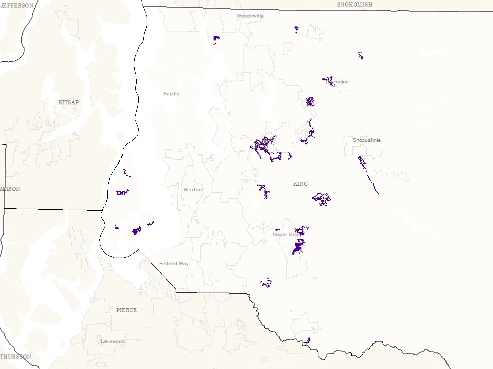
This data is created for display purpose for online mapping application for Parks (ParkFinder).
The data is simplified for the purpose of the application.
Description
Simplified backcountry trails line data.
Trail name may not be the same as the original trail data due to public display of the data for online mapping application.
If you need accurate trail data, please use the trail_line.
Layer information
| Layer Name | bct_general_display_line |
| Subject Category | Recreation |
| Title | Backcountry Trails for General Display |
| Feature Count | 23 |
| Feature Type | Line |
| Next Update | As needed |
| Spatial reference | EPSG:2926 |
| Control ID | 852 |
| Place Keywords | Pacific NW, Washington State, King County, WA |
| Theme Keywords | Backcountry Trail, Recreatn, Backcountry, Parks, Trail, Recreation |
| Supplemental Information |
None |
Attribute information
|
OBJECTID
From ESRI |
Description
Internal feature number. DomainSequential unique whole numbers that are automatically generated. |
|
BCT_Name
No Source Noted |
Description
Backcountry trail name DomainMixed case of string |
|
Hiking
No Source Noted |
Description
Trail usage for hiking allowed Domain1 - Yes |
|
Horseback
No Source Noted |
Description
Trail usage for horseback riding allowed Domain0 - No |
|
MtnBiking
No Source Noted |
Description
Trail usage for mountain biking allowed Domain0 - No |
|
PDF
No Source Noted |
Description
PDF map location DomainMixed case of string |
|
Shape
From ESRI |
Description
Feature geometry. DomainCoordinates defining the features. |
|
Shape.STLength()
From SQL Server |
Description
Returns the total length of the elements in a geometry instance. DomainDouble |
Contact information
| Maintained by | DNRP - Parks and Recreation |
| Primary |
Emily McGinty
Emily.McGinty@kingcounty.gov |
Terms of Use
| License | Terms of use and copyright |
Use this Data
|
Links
How to use in ArcGIS Pro |
|
| Sharing Status | Not Public |
Summary
This data is created for display purpose for online mapping application for Parks (ParkFinder).
The data is simplified for the purpose of the application.
Description
Simplified backcountry trails line data.
Trail name may not be the same as the original trail data due to public display of the data for online mapping application.
If you need accurate trail data, please use the trail_line.
Contact information
| Maintained by | DNRP - Parks and Recreation |
| Primary |
Emily McGinty
Emily.McGinty@kingcounty.gov |
Terms of use and copyright
| License | Terms of use and copyright |
Change history
| Update 1 |
This is currently a manual process. 1) Use trail_line in plibrary, select trails referiing to the SiteName lookup table in Backcountry Trails.docx. 2) Export trails as pf_bct in parkfinder.gdb. 3) Add a field BCT_Name in pf_bct, apply name from docx. 4) Generalize based on BCT_Name, save as bct_general. 5) Join bct_general to bct_use table, hide unnecessariy fields and export to maint. |