
GIS Data Catalog
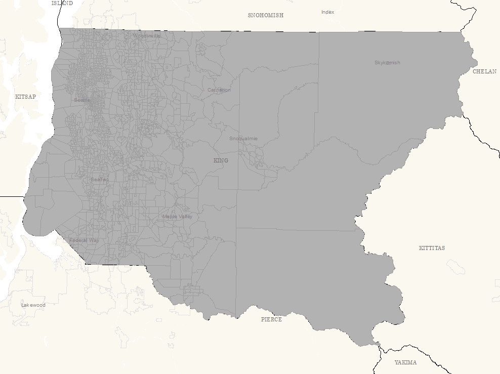
1990 Block Groups
Learn how to get an ArcGIS Online account 🗺
Use this Data
|
Links
How to use in ArcGIS Pro |
|
| Sharing Status | Not Public |
Summary
Census block group area (blocks with the same 100 level) reporting area.
Description
1990 Census Tract/Blocks with the same hundred level
Layer information
| Layer Name | blockgrp_area |
| Subject Category | Census |
| Title | 1990 Block Groups |
| Feature Count | 1866 |
| Feature Type | Polygon |
| Next Update | None planned |
| Spatial reference | EPSG:2926 |
| Control ID | 94 |
| Place Keywords | Pacific NW, Washington State, King County, WA |
| Theme Keywords | Demographic, None, Census |
| Supplemental Information |
None |
Attribute information
|
OBJECTID
From ESRI |
Description
Internal feature number. DomainSequential unique whole numbers that are automatically generated. |
|
STATE_NAME
No Source Noted |
Description
Not Found Domain53 |
|
COUNTY
No Source Noted |
Description
Not Found Domain33 |
|
BLKGRPCODE
No Source Noted |
Description
Not Found DomainNot Found |
|
FMCD
No Source Noted |
Description
Not Found Domain90112, 90928, 91056, 91392, 91728, 92928, 93072, 93392, 93568, 93616 |
|
FPL
No Source Noted |
Description
Not Found Domain1290 to 99999 by 1 |
|
SHAPE
From ESRI |
Description
Feature geometry. DomainCoordinates defining the features. |
|
CTBNA
No Source Noted |
Description
Not Found Domain100 to 33100 by 1 |
|
Shape.STArea()
From SQL Server |
Description
Returns the area of a geometry instance in square units, based on the spatial reference identifier (SRID) of the geometry. DomainDouble |
|
Shape.STLength()
From SQL Server |
Description
Returns the total length of the elements in a geometry instance. DomainDouble |
Contact information
| Maintained by | KCGIS Center |
| Primary |
KCGIS Center
giscenter@kingcounty.gov |
Terms of Use
| License | Terms of use and copyright |
Use this Data
|
Links
How to use in ArcGIS Pro |
|
| Sharing Status | Not Public |
Summary
Census block group area (blocks with the same 100 level) reporting area.
Description
1990 Census Tract/Blocks with the same hundred level
Contact information
| Maintained by | KCGIS Center |
| Primary |
KCGIS Center
giscenter@kingcounty.gov |
Terms of use and copyright
| License | Terms of use and copyright |
Change history
| 9/1/1993 |
Primary RECTIFIED TO KING COUNTY RECDNET COVERAGE. 01/01/1996 Source Scale: 1:100000 Block data received from King County Redistricting Committee via ESRI in digital Arc/Info coverage format. Block polygons rectified to King County Street Network Coverage (kcsn) between September and November 1993. Block polygons rectified to King County RECDNET coverage between June 1996 and April 1997. Refer to documentation block coverage (block) for more information. Blockgrp coverage generated using block group identifier from block coverage and Arc DISSOLVE command. |