
GIS Data Catalog
Current Flood and Channel Migration Hazard List
Learn how to get an ArcGIS Online account 🗺
Use this Data
|
Links
How to use in ArcGIS Pro |
|
| Sharing Status | Not Public |
Summary
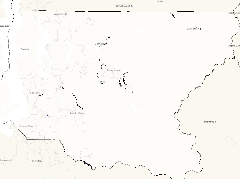
To identify a subset of non-King County properties which pose flood risk and/or channel migration hazards.
Description
Contains a subset of non-King County parcels adjacent to rivers identified as having flood risk and/or channel migration hazards.
Layer information
| Layer Name | currflood_chnlmig_hazlist_area |
| Subject Category | Property |
| Title | Current Flood and Channel Migration Hazard List |
| Feature Count | 638 |
| Feature Type | Polygon |
| Next Update | As needed |
| Spatial reference | EPSG:2926 |
| Control ID | 2833 |
| Place Keywords | Pacific NW, King County, WA, Washington State |
| Theme Keywords | Property, River, Flood, Hazard Mitigation, Natural Resources, Environment, Inlandwaters |
| Supplemental Information | None |
Attribute information
|
OBJECTID
From Esri |
Description
Internal feature number. DomainSequential unique whole numbers that are automatically generated. |
|
PIN
From King County |
Description
10 character Parcel Identification Number Domain10 character Parcel Identification Number |
|
River
From King County |
Description
Name of river adjacent to parcel DomainNames of rivers |
|
InterestType
From King County |
Description
: Proposed type of acquisition (fee or easement) DomainDescription of type of interest |
|
InterestProportion
From King County |
Description
Proposed proportion of acquisition (whole of partial) DomainDescription of interest proportion |
|
RationaleWholeVsPartial
From King County |
Description
Rationale for proposed whole or partial acquisition DomainDescrlption of rationale for proportion of parcel |
|
Purpose
From King County |
Description
Purpose for interest in parcel DomainDescription of purpose for interest in parcel |
|
CIP_ProjectName
From King County |
Description
Capital Improvement Project name DomainList of Capital Improvement Project names |
|
In6yr_CIP_area
From King County |
Description
Identifies whether parcel is in 6 year CIP plan DomainN - No Y - Yes |
|
FullCostIn6yr_CIP
From King County |
Description
Identifies whether the full cost of parcel is in 6 year CIP plan DomainY - Yes N - No O - Opportunistic |
|
KCCD
From King County |
Description
King County Council District Number DomainKing County Council District numbers |
|
Shape
From Esri |
Description
Feature geometry. DomainCoordinates defining the features. |
|
HazardType
From King County Rivers Section |
Description
Type of Hazard Domain0 - Property in neither Channel Migration Hazard Area or in Floodway 1 - Property in Channel Migration Hazard Area 2 - Property in Floodway 3 - Property in Channel Migration Hazard Area and Floodway |
|
LandownerContacts
From King County |
Description
Landowner has been contacted DomainNot Found |
|
Action_
From King County |
Description
Justification for Action DomainNot Found |
|
OnCIS
From King County |
Description
Is proposed acquisition associated with a project or program identified on any of the Capitol Investment Strategies DomainNot Found |
|
Notes
No Source Noted |
Description
Notes DomainNot Found |
|
Shape.STArea()
From SQL Server |
Description
Returns the area of a geometry instance in square units, based on the spatial reference identifier (SRID) of the geometry. DomainDouble |
|
Shape.STLength()
From SQL Server |
Description
Returns the total length of the elements in a geometry instance. DomainDouble |
Contact information
| Maintained by | DNRP - Water and Land Resources |
| Primary |
Harkeerat Kang
Harkeerat.Kang@kingcounty.gov |
Terms of Use
| License | Terms of use and copyright |
Use this Data
|
Links
How to use in ArcGIS Pro |
|
| Sharing Status | Not Public |
Summary
To identify a subset of non-King County properties which pose flood risk and/or channel migration hazards.
Description
Contains a subset of non-King County parcels adjacent to rivers identified as having flood risk and/or channel migration hazards.
Contact information
| Maintained by | DNRP - Water and Land Resources |
| Primary |
Harkeerat Kang
Harkeerat.Kang@kingcounty.gov |
Terms of use and copyright
| License | Terms of use and copyright |
Change history
| Update 1 |
Joined table with attribute info from River and Floodplain Mangement Section on PIN to parcel_area go generate gis layer. |