
GIS Data Catalog
DrainageDistricts_Area
Learn how to get an ArcGIS Online account 🗺
Use this Data
|
Links
How to use in ArcGIS Pro |
|
| Sharing Status | Not Public |
Summary
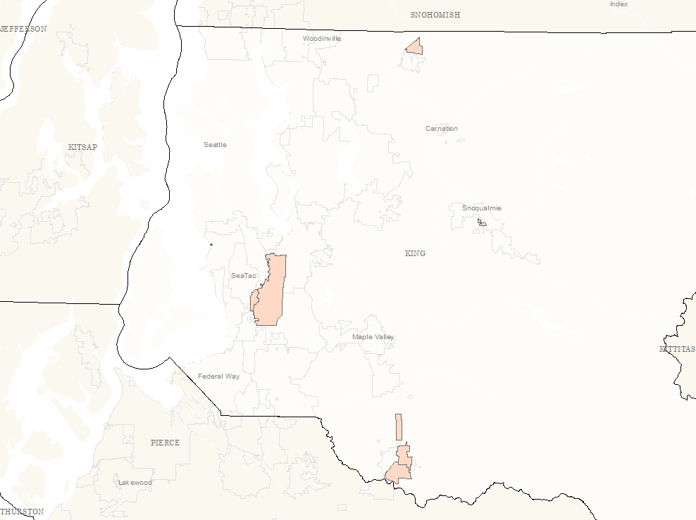
The Drainage Districts layer was created from Department Of Assessments old hand drawn maps of Drainage Districts.
The purpose is to provide digital access to the historic boundaries.
Description
The Drainage Districts layer was created from Department Of Assessments old hand drawn maps of Drainage Districts.
The old maps indicate they were drawn in the 1930s.
There is no supporting documentation available for the old maps.
The digital layer represents the interpretation of the old maps against current and historic imagery layers where available and necessary as noted on the old maps.
The information on the historic source maps was sparse.
Layer information
| Layer Name | drainagedistricts_area |
| Subject Category | Property |
| Title | DrainageDistricts_Area |
| Feature Count | 8 |
| Feature Type | Polygon |
| Next Update | None planned |
| Spatial reference | EPSG:2926 |
| Control ID | 2863 |
| Place Keywords | None |
| Theme Keywords | Historic, Drainage, Districts, Boundaries |
| Supplemental Information | None |
Attribute information
|
OBJECTID
From Esri |
Description
Internal feature number. DomainSequential unique whole numbers that are automatically generated. |
|
Dist_Name
From King County |
Description
Not Found DomainNot Found |
|
Dist_Num
From King County |
Description
Not Found Domain1, 2, 5, 6, 7, 13, 14, 17 |
|
Comments
From King County |
Description
Not Found DomainExtent of north point questionable., Location of North Line questionable., North line is Black River estimated from 1944 imagery., Offset PLSS between Sec012006 and Sec362106, PLSS not square, This district does not collect benefit charges., West boundary along Boeing Creek per 1944 imagery. |
|
EditDate
From King County |
Description
Not Found DomainNot Found |
|
UserId
No Source Noted |
Description
Not Found DomainNot Found |
|
Source
From King County |
Description
Not Found DomainInterpreted from DOA Drainage District Mylar dated ResNo.25619 3-25-63, Interpreted from DOA Drainage District Mylar dated SC. 277665 3-12-35, Interpreted from DOA Drainage District Mylar dated SC. 3-3-39 |
|
Shape
From Esri |
Description
Feature geometry. DomainCoordinates defining the features. |
|
Shape.STArea()
From SQL Server |
Description
Returns the area of a geometry instance in square units, based on the spatial reference identifier (SRID) of the geometry. DomainDouble |
|
Shape.STLength()
From SQL Server |
Description
Returns the total length of the elements in a geometry instance. DomainDouble |
Contact information
| Maintained by | Department of Assessments |
| Primary |
Christie Most
christie.most@kingcounty.gov |
Terms of Use
| License | Terms of use and copyright |
Use this Data
|
Links
How to use in ArcGIS Pro |
|
| Sharing Status | Not Public |
Summary
The Drainage Districts layer was created from Department Of Assessments old hand drawn maps of Drainage Districts.
The purpose is to provide digital access to the historic boundaries.
Description
The Drainage Districts layer was created from Department Of Assessments old hand drawn maps of Drainage Districts.
The old maps indicate they were drawn in the 1930s.
There is no supporting documentation available for the old maps.
The digital layer represents the interpretation of the old maps against current and historic imagery layers where available and necessary as noted on the old maps.
The information on the historic source maps was sparse.
Contact information
| Maintained by | Department of Assessments |
| Primary |
Christie Most
christie.most@kingcounty.gov |
Terms of use and copyright
| License | Terms of use and copyright |
Change history
| Update 1 |
The data was interpreted from historic documents based on section-township-range and other identifying information found on the documents. |