
GIS Data Catalog
Elevated Transportation Structures
Learn how to get an ArcGIS Online account 🗺
Use this Data
|
Links
How to use in ArcGIS Pro |
|
| Sharing Status | Not Public |
Summary
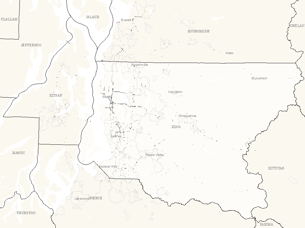
Provides areal extent to elevated structures as well as edge line definition.
One use is in ortho rectification for defining areas that may need to be inspected for accurate rectification.
Description
Polygons defining elevated transportation structures: bridges, overpasses, highway ramps.
Primarily elevated roadway features, but also includes railway structures.
Layer information
| Layer Name | elev_trans_structure_area |
| Subject Category | Survey |
| Title | Elevated Transportation Structures |
| Feature Count | 1166 |
| Feature Type | Polygon |
| Next Update | Annually |
| Spatial reference | EPSG:2926 |
| Control ID | 741 |
| Place Keywords | Pacific NW, Washington State, King County, WA |
| Theme Keywords | Transportation, Survey, Reference Grids |
| Supplemental Information |
None |
Attribute information
|
OBJECTID
From ESRI |
Description
Internal feature number. DomainSequential unique whole numbers that are automatically generated. |
|
SHAPE
From ESRI |
Description
Feature Geometry DomainCoordinates defining the features |
|
STRUCCLASS
From King County |
Description
Structure Class Domain1 - Simple structure; usually single lane; no ramps 2 - Complex elevated structure; multilane or with ramps |
|
FEATURE_ID
No Source Noted |
Description
Not Found DomainNot Found |
|
DATASOURCE
No Source Noted |
Description
Not Found DomainNot Found |
|
EDITED
From King County |
Description
Edited Status Domain-9 - Not edited; raw data location and definition only 1 - Edited and modified against most current imagery |
|
Shape.STArea()
From SQL Server |
Description
Returns the area of a geometry instance in square units, based on the spatial reference identifier (SRID) of the geometry. DomainDouble |
|
Shape.STLength()
From SQL Server |
Description
Returns the total length of the elements in a geometry instance. DomainDouble |
Contact information
| Maintained by | KCGIS Center |
| Primary |
KCGIS Center
giscenter@kingcounty.gov |
Terms of Use
| License | Terms of use and copyright |
Use this Data
|
Links
How to use in ArcGIS Pro |
|
| Sharing Status | Not Public |
Summary
Provides areal extent to elevated structures as well as edge line definition.
One use is in ortho rectification for defining areas that may need to be inspected for accurate rectification.
Description
Polygons defining elevated transportation structures: bridges, overpasses, highway ramps.
Primarily elevated roadway features, but also includes railway structures.
Contact information
| Maintained by | KCGIS Center |
| Primary |
KCGIS Center
giscenter@kingcounty.gov |
Terms of use and copyright
| License | Terms of use and copyright |
Change history
| 8/1/2010 |
During review of 2010 iTen orthophotography 7500x7500 tiles, additional features were added. Existing features were not modified. |
| 1/1/2009 |
Various source data were collected that defined bridges, elevated structures, etc. If data was point data, a generic buffer feature was created. All features were appended and dissolved to remove overlaps. To assist in definition of what portion of the structure was elevated, a supporting layer was created from the last return and bare earth lidar data. |
| Update 3 |
Using the 2009 Pictometry imagery, each of the compiled features was evaluated and modified to align with the imagery. |