
GIS Data Catalog
Farm Conservation Plans
Learn how to get an ArcGIS Online account 🗺
Use this Data
|
Links
How to use in ArcGIS Pro |
|
| Sharing Status | Not Public |
Summary
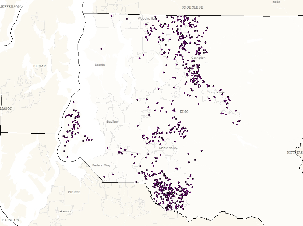
One point for each Farm Conservation Plan for years 2008-2017
Description
KCD Farm Conservation Plans are documents developed jointly by King Conservation District and land managers.
Farm Conservation Plans include actions that land managers can take to achieve their land use goals while protecting water and other natural resources.
The planning process takes into consideration the size of the farm, type of soils, slope of the land, proximity to streams or water bodies, type of livestock or crops, and resources such as machinery, buildings and available finances.
Layer information
| Layer Name | farmplan_point |
| Subject Category | Natural Resources |
| Title | Farm Conservation Plans |
| Feature Count | 814 |
| Feature Type | Point |
| Next Update | As needed |
| Spatial reference | EPSG:2926 |
| Control ID | 2730 |
| Place Keywords | Pacific NW, King County, WA, Washington State |
| Theme Keywords | Natres, Agriculture, Farm, Conservation, Natural Resource Management, Plan, Farming, Environment |
| Supplemental Information |
http://kingcd.org/programs/better-food/farm-conservation-planning/ |
Attribute information
|
OBJECTID
From Esri |
Description
Internal feature number. DomainSequential unique whole numbers that are automatically generated. |
|
Shape
From Esri |
Description
Feature geometry. DomainCoordinates defining the features. |
Contact information
| Maintained by | DNRP - Water and Land Resources |
| Primary |
Harkeerat Kang
Harkeerat.Kang@kingcounty.gov |
Terms of Use
| License | Terms of use and copyright |
Use this Data
|
Links
How to use in ArcGIS Pro |
|
| Sharing Status | Not Public |
Summary
One point for each Farm Conservation Plan for years 2008-2017
Description
KCD Farm Conservation Plans are documents developed jointly by King Conservation District and land managers.
Farm Conservation Plans include actions that land managers can take to achieve their land use goals while protecting water and other natural resources.
The planning process takes into consideration the size of the farm, type of soils, slope of the land, proximity to streams or water bodies, type of livestock or crops, and resources such as machinery, buildings and available finances.
Contact information
| Maintained by | DNRP - Water and Land Resources |
| Primary |
Harkeerat Kang
Harkeerat.Kang@kingcounty.gov |
Terms of use and copyright
| License | Terms of use and copyright |
Change history
| 3/22/2018 |
Created by matching parcel numbers to parcel layer, and generating one point for each farm location |