
GIS Data Catalog
1990 Forecast Analysis Zones
Learn how to get an ArcGIS Online account 🗺
Use this Data
|
Links
How to use in ArcGIS Pro |
|
| Sharing Status | Not Public |
Summary
Used for demographic and economic analysis.
Description
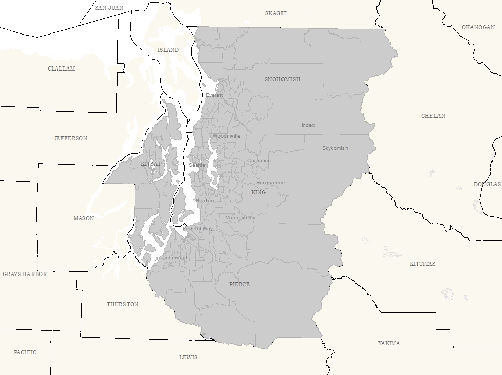
Population Forecast Analysis Zones for greater Puget Sound.
Each unit is defined by a collection of census blocks and tracts.
Layer information
| Layer Name | faz_area |
| Subject Category | Census |
| Title | 1990 Forecast Analysis Zones |
| Feature Count | 284 |
| Feature Type | Polygon |
| Next Update | None planned |
| Spatial reference | EPSG:2926 |
| Control ID | 97 |
| Place Keywords | Pacific NW, Snohomish County, Washington State, King County, WA, Pierce County |
| Theme Keywords | Demographic, None, Census |
| Supplemental Information |
None |
Attribute information
|
FAZ
No Source Noted |
Description
Not Found Domain110 to 9999 by 1 |
|
OBJECTID
From ESRI |
Description
Internal feature number. DomainSequential unique whole numbers that are automatically generated. |
|
SHAPE
From ESRI |
Description
Feature geometry. DomainCoordinates defining the features. |
|
Shape.STArea()
From SQL Server |
Description
Returns the area of a geometry instance in square units, based on the spatial reference identifier (SRID) of the geometry. DomainDouble |
|
Shape.STLength()
From SQL Server |
Description
Returns the total length of the elements in a geometry instance. DomainDouble |
Contact information
| Maintained by | KCGIS Center |
| Primary |
KCGIS Center
giscenter@kingcounty.gov |
Terms of Use
| License | Terms of use and copyright |
Use this Data
|
Links
How to use in ArcGIS Pro |
|
| Sharing Status | Not Public |
Summary
Used for demographic and economic analysis.
Description
Population Forecast Analysis Zones for greater Puget Sound.
Each unit is defined by a collection of census blocks and tracts.
Contact information
| Maintained by | KCGIS Center |
| Primary |
KCGIS Center
giscenter@kingcounty.gov |
Terms of use and copyright
| License | Terms of use and copyright |
Change history
| 1/1/1990 |
Layer has been projected to Washington State Plane Coordinates but not conflated to King County geography. Imbedded water bodies may not coincide with DNR water bodies coverage (wtrbdy) or TIGER water bodies coverage (wtr-body). Spatial data should not be edited in expectation of updates from outside Department of Metropolitan Services. |