
GIS Data Catalog
1970 USGS Topo Current
Learn more by reading the GIS FAQ 🗺
Summary
General use for orientation to natural and manmade features and general elevation.
Must be used with disgression due to changes in the real world that are not updated in the images.
Description
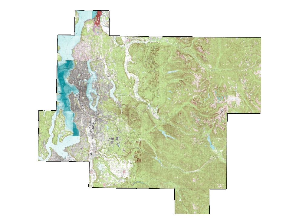
USGS digital raster graphics (drg) are color image versions of the USGS topographical series maps.
The vintage of the original input data varies considerably and has not been updated even if the USGS has updated the base data.Two series (1).
USGS 1:24,000 (7.5 minute) Topographic Maps of various recent vintage There is no survey publication information available on the 1:24,000 series (2).
USGS 1:125,000 (30 minute) historic Topographic Maps (vintage range 1890 to 1920).Details on vintage of 1:125,000 historic series, based on information printed in borders of unmerged quadrangles: The image mosaic is made up of 6 quads Top row from left to right: Snohomish Surveyed 1983-95, published 1895; Sultan Surveyed 1919-21, published 1921; Skykomish Surveyed 1897 and 1902, published 1902; Bottom row left to right: Tacoma Surveyed 1894-95, published 1900; Cedar Lake Surveyed 1910-11,.
published 1913; Snoqualmie Pass Surveyed 1900-01, published 1901.
Layer information
| Layer Name | IMAGE_DrgUSGSTopoCurrent |
| Subject Category | Imagery |
| Title | 1970 USGS Topo Current |
| Feature Count | 1 |
| Feature Type | Raster |
| Spatial reference | None |
| Control ID | None |
| Place Keywords | None |
| Theme Keywords | Digital Raster Graphics, USGS Topographical Maps, 1:24, 000 Topo Maps, Place Names |
| Supplemental Information | None |
Attribute information
|
OBJECTID
From ESRI |
Description
Internal feature number. DomainSequential unique whole numbers that are automatically generated. |
|
Shape
From ESRI |
Description
Feature geometry. DomainCoordinates defining the features. |
|
Shape_Length
From Esri |
Description
Length of feature in internal units. DomainPositive real numbers that are automatically generated. |
|
Shape_Area
From Esri |
Description
Area of feature in internal units squared. DomainPositive real numbers that are automatically generated. |
|
MosaicID
No Source Noted |
Description
Not Found DomainNot Found |
Contact information
| Maintained by | KCGIS Center |
| Primary |
KCGIS Center
giscenter@kingcounty.gov |
Terms of Use
| License | Terms of use and copyright |
Summary
General use for orientation to natural and manmade features and general elevation.
Must be used with disgression due to changes in the real world that are not updated in the images.
Description
USGS digital raster graphics (drg) are color image versions of the USGS topographical series maps.
The vintage of the original input data varies considerably and has not been updated even if the USGS has updated the base data.Two series (1).
USGS 1:24,000 (7.5 minute) Topographic Maps of various recent vintage There is no survey publication information available on the 1:24,000 series (2).
USGS 1:125,000 (30 minute) historic Topographic Maps (vintage range 1890 to 1920).Details on vintage of 1:125,000 historic series, based on information printed in borders of unmerged quadrangles: The image mosaic is made up of 6 quads Top row from left to right: Snohomish Surveyed 1983-95, published 1895; Sultan Surveyed 1919-21, published 1921; Skykomish Surveyed 1897 and 1902, published 1902; Bottom row left to right: Tacoma Surveyed 1894-95, published 1900; Cedar Lake Surveyed 1910-11,.
published 1913; Snoqualmie Pass Surveyed 1900-01, published 1901.
Contact information
| Maintained by | KCGIS Center |
| Primary |
KCGIS Center
giscenter@kingcounty.gov |
Terms of use and copyright
| License | Terms of use and copyright |