
GIS Data Catalog
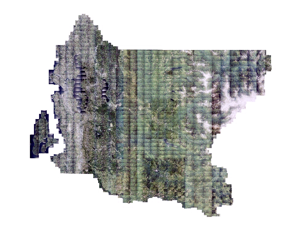
2002 Color Aerial Photography for King County
Learn more by reading the GIS FAQ 🗺
Summary
The 2002 King County orthorectified color imagery updates the King County Spatial Data Warehouse.
Data is available for a range of internal and external GIS, engineering and other mapping applications.
This data replaces Version 1 of the 2002 King County data which was stored in a lower-resolution format.
The King County data provides full-county coverage.
Description
Natural color orthophotography acquired in July 2002 covering approximately 2300 square miles of King County (including Vashon Island) and southwestern Snohomish County.
Data was orthorectified using Lidar Digital Ground Model terrain information and tiled in a seamless mosaic.
Default seamline matching was used.
Original diapositive images were scanned at 11.5 microns yielding pre-orthophoto rectification raw pixal sizes of 0.77 feet for the 1"=1700' and 1.13 feet for the 1"=2500' data sets.
Final output ground sample distance (gsd) is 1 feet for entire mosaic.
Data is provided in MrSid compressed format at a 1:7 ratio.
This lossy compression results in variable data quality and clarity.
Orthorectified tiff files are available for this dataset.
Larger zone and keyregion mosaics are also available, but at a higher compression, thus lower-resolution format.
Layer information
| Layer Name | IMAGE_Ortho2002KCNAT |
| Subject Category | Imagery |
| Title | 2002 Color Aerial Photography for King County |
| Feature Count | 1 |
| Feature Type | Raster |
| Next Update | As needed |
| Spatial reference | None |
| Control ID | None |
| Place Keywords | Pacific NW, Southwestern Snohomish County, King County, Washington State, Vashon Island, WA |
| Theme Keywords | Natural Color Photography, Digital Color Aerial Photography, Orthophotography, Orthorectified Photography |
| Supplemental Information |
The primary access to this data will be in a compressed MrSid format. Images are tiled to the King County idxptrmbr tile scheme - a tile scheme based on the PLSS township-range organization. See the KCGIS Spatial Data Catalog < https://www5.kingcounty.gov/sdc/index.htm > for more information on how King County imagery and other raster data is organized. |
Attribute information
|
OBJECTID
From Esri |
Description
Internal feature number. DomainSequential unique whole numbers that are automatically generated. |
|
Shape
From Esri |
Description
Feature geometry. DomainCoordinates defining the features. |
|
Shape_Length
From Esri |
Description
Length of feature in internal units. DomainPositive real numbers that are automatically generated. |
|
Shape_Area
From Esri |
Description
Area of feature in internal units squared. DomainPositive real numbers that are automatically generated. |
|
MosaicID
No Source Noted |
Description
Not Found DomainNot Found |
Contact information
| Maintained by | KCGIS Center |
| Primary |
KCGIS Center
giscenter@kingcounty.gov |
Terms of Use
| License | Terms of use and copyright |
Summary
The 2002 King County orthorectified color imagery updates the King County Spatial Data Warehouse.
Data is available for a range of internal and external GIS, engineering and other mapping applications.
This data replaces Version 1 of the 2002 King County data which was stored in a lower-resolution format.
The King County data provides full-county coverage.
Description
Natural color orthophotography acquired in July 2002 covering approximately 2300 square miles of King County (including Vashon Island) and southwestern Snohomish County.
Data was orthorectified using Lidar Digital Ground Model terrain information and tiled in a seamless mosaic.
Default seamline matching was used.
Original diapositive images were scanned at 11.5 microns yielding pre-orthophoto rectification raw pixal sizes of 0.77 feet for the 1"=1700' and 1.13 feet for the 1"=2500' data sets.
Final output ground sample distance (gsd) is 1 feet for entire mosaic.
Data is provided in MrSid compressed format at a 1:7 ratio.
This lossy compression results in variable data quality and clarity.
Orthorectified tiff files are available for this dataset.
Larger zone and keyregion mosaics are also available, but at a higher compression, thus lower-resolution format.
Contact information
| Maintained by | KCGIS Center |
| Primary |
KCGIS Center
giscenter@kingcounty.gov |
Terms of use and copyright
| License | Terms of use and copyright |
Change history
| 1/1/2004 |
Output orthorectified idxp7500 tiles in TIFF format are clipped to the idxptrmbr boundary and compressed using MrSid format compression. The compression ratio is 1:7. |
| 1/1/2003 |
Images and terrain information were input into the Ortho/Mosaic module in SOCET SET from Leica Geosystems and BAE. A list of all images required for the project area, as well as the name of the digital terrain file were provided to the software. The lower-left and upper-right coordinates of each idxp7500 Bounding Rectangle tile was provided and the program was executed. The ortho/mosaic seamline autogenerated by the software were not reviewed or edited. Bridges and overpasses/interchanges were not modeled during the orthorectification process. They are rectified to the ground per the LiDAR terrain model, as are all elevated/non-ground features. The orthophotos were not given a comprehensive quality evaluation. |
| 12/1/2002 |
Digital terrain information was extracted from LiDAR rasters in ArcInfo Grid format captured in 2002. A composite grid based on 100 foot buffered idxp7500 index tiles that are resampled to 12 feet and converted to a point coverage using the GRIDPOINT command. ADDXY command was used to append coordinates to the attribute table. The PAT attribute table was unloaded to an ASCII file. The terrain information was not edited. |
| 11/1/2002 |
Photos were acquired using standard film-based technology by Bergman and Associates under subcontract to 3di West. Photos were captured in stereo configuration. Aerial Triangulationwas performed utilizing airborne GPS and ground control to orient the photos to the Washington State Plane (North Zone) coordinate system.These low-level photos were collected at a photo scale of 1"=1700', and the high-level photos at 1" = 2500', with a 6" camera focal length. The film negatives were scanned at 11.5 microns by 3di, Easton, MD resulting in a pre-orthophoto rectified nominal pixel size of 0.77 feet for the low-level and 1.13 feet for the high-level. The digital images were output in Tiff-tiled format with separate planar configuration, with pyramid layers. The scanned images were delivered to King County for quality assessment on portable harddrives. |