
GIS Data Catalog
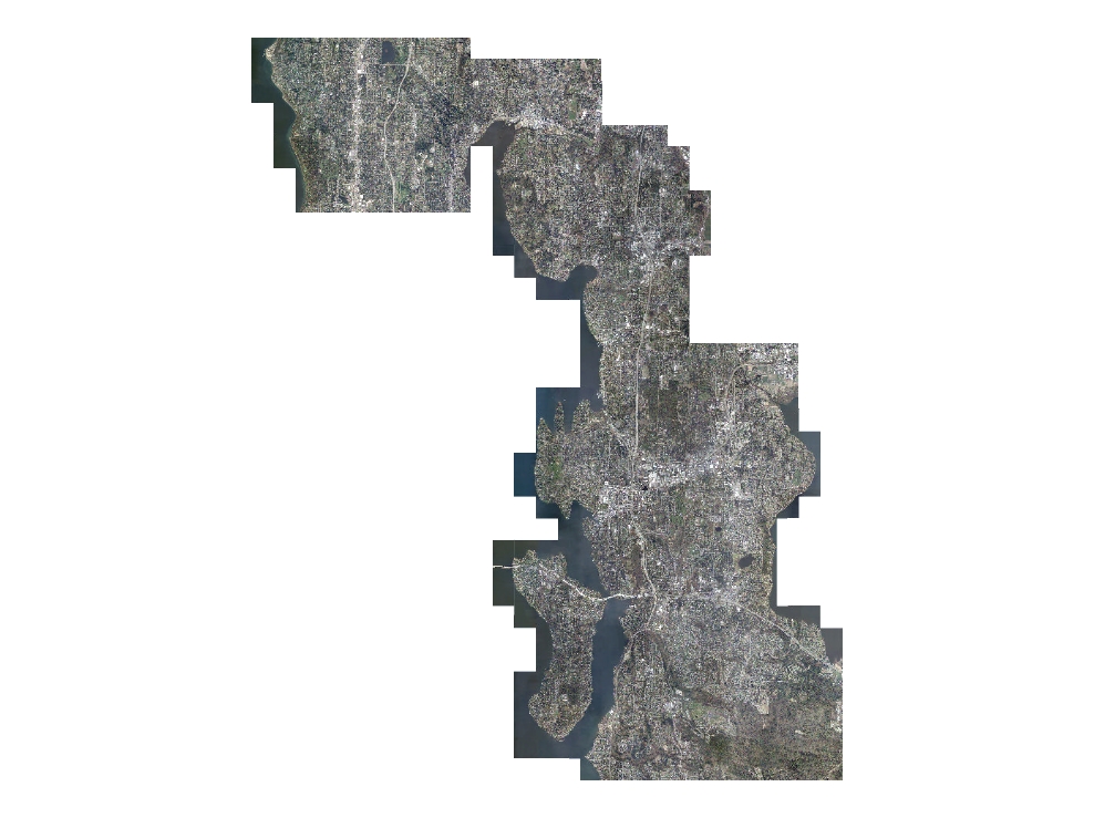
2009 eCityGov Alliance Natural Color Orthoimagery
Learn more by reading the GIS FAQ 🗺
Summary
High-resolution, high-accuracy data for multiple business purposes.
Description
Year 2009 (early Spring), leaf-off, natural color orthoimagery acquired by the eCityGov Alliance for partnering cities - Mercer Island, Bellevue, Kirkland, Bothell and Shoreline.
Vendor was MJ Harden.
Pixel resolution is 0.25 foot.
Layer information
| Layer Name | IMAGE_Ortho2009eCityGovNat |
| Subject Category | Imagery |
| Title | 2009 eCityGov Alliance Natural Color Orthoimagery |
| Feature Count | 1 |
| Feature Type | Raster |
| Next Update | None planned |
| Spatial reference | None |
| Control ID | None |
| Place Keywords | United States, King County; WA, Washington State, Pacific NW |
| Theme Keywords | Orthophotography, Color Infrared Imagery, Orthoimagery, Imagerybasemapsearthcover |
| Supplemental Information |
None |
Attribute information
|
OBJECTID
From Esri |
Description
Internal feature number. DomainSequential unique whole numbers that are automatically generated. |
|
Shape
From Esri |
Description
Feature geometry. DomainCoordinates defining the features. |
|
Shape_Length
From Esri |
Description
Length of feature in internal units. DomainPositive real numbers that are automatically generated. |
|
Shape_Area
From Esri |
Description
Area of feature in internal units squared. DomainPositive real numbers that are automatically generated. |
|
MosaicID
No Source Noted |
Description
Not Found DomainNot Found |
Contact information
| Maintained by | KCGIS Center |
| Primary |
KCGIS Center
giscenter@kingcounty.gov |
Terms of Use
| License | Terms of use and copyright |
Summary
High-resolution, high-accuracy data for multiple business purposes.
Description
Year 2009 (early Spring), leaf-off, natural color orthoimagery acquired by the eCityGov Alliance for partnering cities - Mercer Island, Bellevue, Kirkland, Bothell and Shoreline.
Vendor was MJ Harden.
Pixel resolution is 0.25 foot.
Contact information
| Maintained by | KCGIS Center |
| Primary |
KCGIS Center
giscenter@kingcounty.gov |
Terms of use and copyright
| License | Terms of use and copyright |
Change history
| 5/15/2010 |
The database size was too large to mosaic as a single sid even at high compression. The data was resampled to 6 inch and a mosaic was also created for the affected Northwest Zone tile (35x compression) . A key region mosaic was created at 50x compression. Even though the key region mosaic covers that same area as the zone mosaic, it provides the complete dataset in a smaller file footprint. |
| 3/1/2010 |
Data acquired from eCityGov Alliance in March 2010 via portable harddrive and DVD. Data was copied to workspace. Compressed MrSid versions (20x) were created for each tile for preliminary QA, horizontal accuracy analysis, and completion of extent shapefile. No spatial index was delivered with the data. A python routine was created to create a photo centroid layer. This point layer was buffered by 1600 feet to create a polygon footprint index. The photo center to edge is only 1500 feet, but the buffer was created larger than the image because the delivered tiles extent coincides in places with the King County 7500 grid. The overlap ensures that tile selection during subsequent processing does not miss an edge tile. |
| 2/1/2010 |
MrSid (v7) was used to create Generation 3 SID (lossless) mosaics in the King County 7500-ft tiling scheme. Another similar routine was used to create Generation 3 mosaics (15x compression) in the King County Township-Range tiling scheme. |
| Update 4 |
Redefined Projection for all sids to be compliant with King County standard. |