
GIS Data Catalog
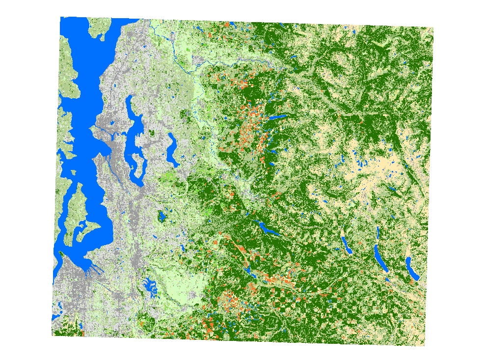
2001 Landcover interpretation from Landsat imagery
Learn more by reading the GIS FAQ 🗺
Summary
Landcover interpretation from 2001 Landsat imagery
Description
Landcover interpretation from 2001 Landsat imagery
Layer information
| Layer Name | LANDCOVER_Landcover2001Landsat |
| Subject Category | Imagery |
| Title | 2001 Landcover interpretation from Landsat imagery |
| Feature Count | 1 |
| Feature Type | Raster |
| Spatial reference | None |
| Control ID | None |
| Place Keywords | Washington State, Pacific NW, King County, WA |
| Theme Keywords | |
| Supplemental Information | None |
Attribute information
|
OBJECTID
From ESRI |
Description
Internal feature number. DomainSequential unique whole numbers that are automatically generated. |
|
Shape
From ESRI |
Description
Feature geometry. DomainCoordinates defining the features. |
|
Shape_Length
From Esri |
Description
Length of feature in internal units. DomainPositive real numbers that are automatically generated. |
|
Shape_Area
From Esri |
Description
Area of feature in internal units squared. DomainPositive real numbers that are automatically generated. |
|
MosaicID
No Source Noted |
Description
Not Found DomainNot Found |
Contact information
| Maintained by | KCGIS Center |
| Primary |
KCGIS Center
giscenter@kingcounty.gov |
Terms of Use
| License | Terms of use and copyright |
Summary
Landcover interpretation from 2001 Landsat imagery
Description
Landcover interpretation from 2001 Landsat imagery
Contact information
| Maintained by | KCGIS Center |
| Primary |
KCGIS Center
giscenter@kingcounty.gov |
Terms of use and copyright
| License | Terms of use and copyright |