
GIS Data Catalog
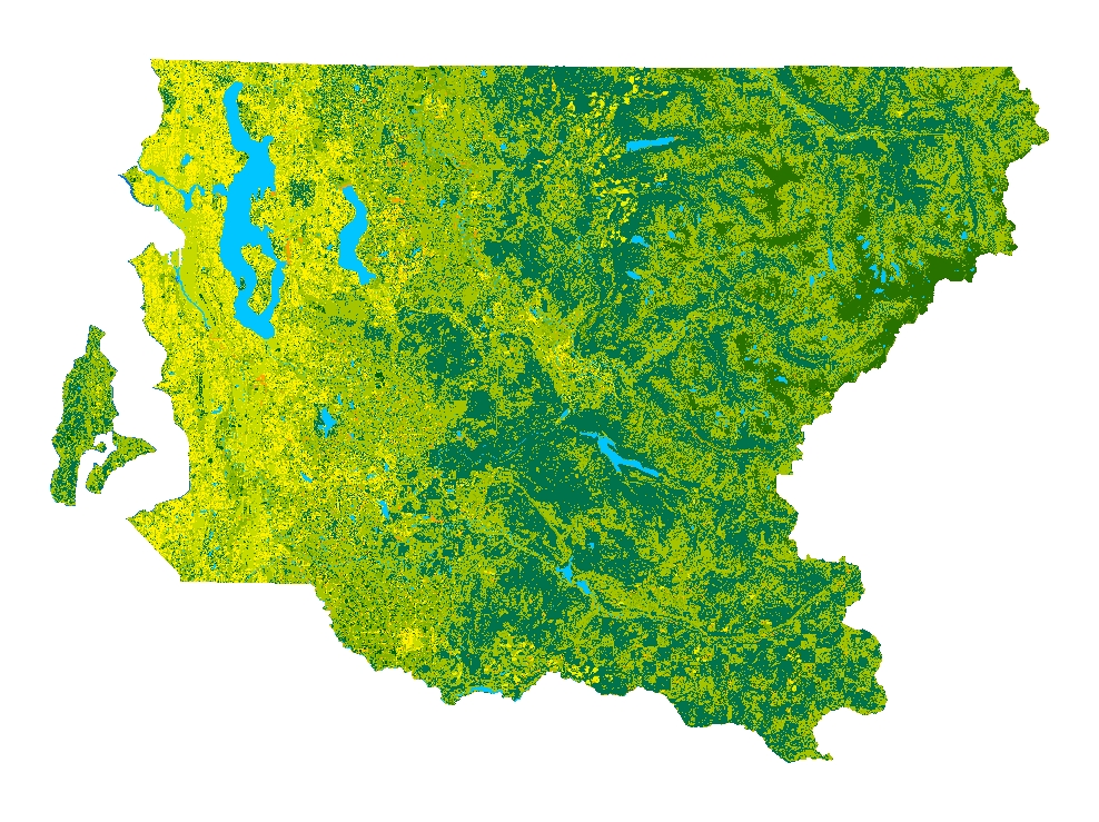
2002 Land-cover Analysis of the Greater Puget Sound Region - King County portion
Learn more by reading the GIS FAQ 🗺
Summary
Landcover classification as input to the Puget Sound Regional Synthesis Model (PRISM);a major University of Washington, inter-disciplinary project that models the inter-related dynamics of regional atmosphere, land-surface processes, marine environment,biological reserves, urbanization and information technologies.
Detailed information is included in documents linked through Supplemental_Information
Description
2002 landcover analysis of the greater Puget Sound region with 17 classes or categories; King County portion only.
The datasets cover the full map extent of the Greater Puget Sound Region and the full spatial extent of twelve Washington counties, including Whatcom, San Juan, Skagit, Island, Snohomish, Jefferson, Kitsap, King, Grays Harbor, Mason, Thurston and Pierce.
Large portions of other counties are also covered.
Layer information
| Layer Name | LANDCOVER_Landcover2002Landsat |
| Subject Category | Imagery |
| Title | 2002 Land-cover Analysis of the Greater Puget Sound Region - King County portion |
| Feature Count | 1 |
| Feature Type | Raster |
| Next Update | None planned |
| Spatial reference | None |
| Control ID | None |
| Place Keywords | WA, Washington State, King County, Pacific NW |
| Theme Keywords | Landcover, PRISM, Thematic Mapper, Landsat |
| Supplemental Information |
https://www5.kingcounty.gov/sdc/raster/landcover/Final_PRISM_report02.doc https://www5.kingcounty.gov/sdc/raster/landcover/Note_on_data_use_March05.rtf |
Attribute information
|
OBJECTID
From ESRI |
Description
Internal feature number. DomainSequential unique whole numbers that are automatically generated. |
|
Shape
From ESRI |
Description
Feature geometry. DomainCoordinates defining the features. |
|
Shape_Length
From Esri |
Description
Length of feature in internal units. DomainPositive real numbers that are automatically generated. |
|
Shape_Area
From Esri |
Description
Area of feature in internal units squared. DomainPositive real numbers that are automatically generated. |
|
MosaicID
No Source Noted |
Description
Not Found DomainNot Found |
Contact information
| Maintained by | KCGIS Center |
| Primary |
KCGIS Center
giscenter@kingcounty.gov |
Terms of Use
| License | Terms of use and copyright |
Summary
Landcover classification as input to the Puget Sound Regional Synthesis Model (PRISM);a major University of Washington, inter-disciplinary project that models the inter-related dynamics of regional atmosphere, land-surface processes, marine environment,biological reserves, urbanization and information technologies.
Detailed information is included in documents linked through Supplemental_Information
Description
2002 landcover analysis of the greater Puget Sound region with 17 classes or categories; King County portion only.
The datasets cover the full map extent of the Greater Puget Sound Region and the full spatial extent of twelve Washington counties, including Whatcom, San Juan, Skagit, Island, Snohomish, Jefferson, Kitsap, King, Grays Harbor, Mason, Thurston and Pierce.
Large portions of other counties are also covered.
Contact information
| Maintained by | KCGIS Center |
| Primary |
KCGIS Center
giscenter@kingcounty.gov |
Terms of use and copyright
| License | Terms of use and copyright |