
GIS Data Catalog
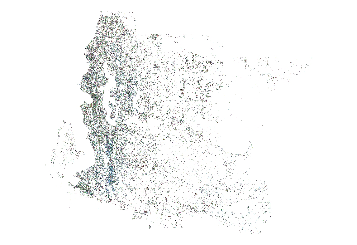
2009 Impervious and Impacted Surface of King County Washington
Learn more by reading the GIS FAQ 🗺
Summary
Provide a project-wide (King County and southwest Snohomish county) generalized interpretation of impervious and impacted surface current to 2009 for those areas completed.
By exclusion, null value areas imply vegetated or water.
Can to be used, within limitations of accuracy, to determine the distribution of these types of surfaces across the project area and to make first-order areal calculations.
Description
Year 2009 Impervious/Impacted Surface data updated with ancillary vector sources and interpreted, manual, updates from 2009 imagery.
See COMPLETENESS section in data quality for status of update progress.
Refer to metadata for x_imp for all other background information on original impervious surface development.
Layer information
| Layer Name | LANDCOVER_Landcover2009Impervious |
| Subject Category | Imagery |
| Title | 2009 Impervious and Impacted Surface of King County Washington |
| Feature Count | 1 |
| Feature Type | Raster |
| Next Update | As needed |
| Spatial reference | None |
| Control ID | None |
| Place Keywords | State Of Washington, Puget Sound Lowlands, United States, WA, Washington, Pacific Northwest, Pacific NW, Southwestern Snohomish County, King County, Western Cascade Mountains |
| Theme Keywords | Roads And Streets, Parking Lots, Manmade Surface, Impervious Surface, Non-Permeable Surface, Impacted Surface, Buildings, Concrete, Asphalt, Transportation |
| Supplemental Information | None |
Attribute information
|
OBJECTID
From ESRI |
Description
Internal feature number. DomainSequential unique whole numbers that are automatically generated. |
|
Shape
From Esri |
Description
Feature geometry. DomainCoordinates defining the features. |
|
Shape_Length
From Esri |
Description
Length of feature in internal units. DomainPositive real numbers that are automatically generated. |
|
Shape_Area
From Esri |
Description
Area of feature in internal units squared. DomainPositive real numbers that are automatically generated. |
|
MosaicID
No Source Noted |
Description
Not Found DomainNot Found |
Contact information
| Maintained by | KCGIS Center |
| Primary |
KCGIS Center
giscenter@kingcounty.gov |
Terms of Use
| License | Terms of use and copyright |
Summary
Provide a project-wide (King County and southwest Snohomish county) generalized interpretation of impervious and impacted surface current to 2009 for those areas completed.
By exclusion, null value areas imply vegetated or water.
Can to be used, within limitations of accuracy, to determine the distribution of these types of surfaces across the project area and to make first-order areal calculations.
Description
Year 2009 Impervious/Impacted Surface data updated with ancillary vector sources and interpreted, manual, updates from 2009 imagery.
See COMPLETENESS section in data quality for status of update progress.
Refer to metadata for x_imp for all other background information on original impervious surface development.
Contact information
| Maintained by | KCGIS Center |
| Primary |
KCGIS Center
giscenter@kingcounty.gov |
Terms of use and copyright
| License | Terms of use and copyright |
Change history
| 1/1/2010 |
The 2009 Impervious layer was rebuilt using Aerial Express 2009 Near Infra Red photography that completely replaces the DAIS data (Vashon Island) and the Emerge data. Ikons data for Eastern King County was retained for the 2009 update. The 2000 & 2008 TNET street layers are replaced with 2010-2011 TNET. The photography was mosaic from an external 2tb drive to AE_8bit using python script: AE_Mosaic.py AE_Mosaic.py uses the text file: tif_list8bit.txt. This is a list of the images on the external drive that were hand picked for mosaic. Due to the long process time and redundant overlaying of images, selected images were used instead of all of the images. The mosaic script copied the 16 bit 1 foot image from the external drive, resample the 16 bit image to 8 bit and 1 foot to 2 feet. Mosaic to AE_8bit. Batch file: (update.bat) that runs the python script: AE_NDVI_Mosaic.py with arguments for township, range, x offset, and y offset for the entire AE IR area of King County. The x\y offsets are for adjusting the image position using 2009 Pictometry photography as the target geometry. The AE_NDVI_Mosaic.py script processes the GRID cells by subtracting band 2 from band 1, reclassifying values 15 and less to 1, values greater than 15 to 0 to produce a GRID with the township\range name with "null" as a suffix, i.e. t19r07null in the folder: raster Townships outside of the Aerial Express data extent were built using Python script: create_new_raster.py The GRIDs are now ready for commission error editing using Arcmap, Arcscan, GRIDPAINT. The 2007 impervious layer was clipped to delete the area covered by AE. The values for the two TNET layers were reclassed to NoData. External building and impervious layers from cities Auburn, Bellevue, Bothell, Burien, Des Monies, Federal Way, Kent, Kirkland, Mercer Island, Redmond, Renton, SeaTac, Seattle, Shoreline, Tacoma, Tukwila, and Woodinville are coded with their source code, rasterized and mosaic to footprints by Python script: mosaic_footprints.py Final mosaic of external data, TNET, and Aerial Express townships are put together using Python script: final2009_mosaic.py. A mosaic of the entire county is built as: IMP_2009. IMP_2009 is copied to GISPROD_raster_maint.sde\RASTER_MAINT.GISC.IMPSURF_2009. Pyramids are then built. IMP_2009 is reclassified using remap_all_values.txt to IMPSURF_2009 to reclass "0" value to "NoData". Items "IMP" and "SOURCE" , SHORT INTEGER, are added by hand to IMPSURF_2009. IMP is calculated to 1 for all values. IMPSURF_2009 is joined with vat_data_lut.dbf, then SOURCE is calculated from vat_data_lut.dbf A_SOURCE, then unjoined by hand. Township grids are clipped from GISPROD_raster_maint.sde\RASTER_MAINT.GISC.IMPSURF_2009 using idxptrmbr.shp in Python script: TownshipGridByMask.py Zone grids are clipped using Python script:. |
| unknown |
External city shapefile data was added with new source Values: Value 2, Auburn buildings dated 2010 Value 2, Auburn Driveways dated 2010 Value 2, Auburn Parking dated 2010 Value 2, Auburn Sidewalk dated 2010 Value 2, Auburn Streets dated 2010 Value 3, Bellevue buildings dated 2010 Value 4, Bothell buildings dated 2010 Value 4, Bothell streets dated 2010 Value 4, Bothell Sidewalks dated 2010 Value 5, Burien buildings dated 2010 Value 6, Des Moines buildings dated 2010 Value 7, Federal Way buildings dated 2010 Value 7, Federal Way impervious dated 2010 Value 8, Kent building outlines dated 2010 Value 8, Kent Impervious dated 2010 Value 9, Kirkland impervious dated 2010 Value 9, Kirkland buildings dated 2010 Value 10, Mercer Island Paved Driveways dated 2009 Value 10, Mercer Island Unpaved Driveway dated 2009 Value 10, Mercer Island Paved Parking dated 2009 Value 10, Mercer Island Unpaved Parking dated 2009 Value 10, Mercer Island Paved Road dated 2009 Value 10, Mercer Island Building dated 2010 Value 10, Mercer Island Sidewalk dated 2009 Value 11, Redmond Buildings dated 2010 Value 11, Redmond Pavement dated 2008 Value 12, Renton Buildings dated 2010 Value 13, SeaTac buildings dated 2010 Value 13, SeaTac Paved Edge dated 2010 Value 14, Seattle Buildings dated 2010 Value 15, Shoreline Buildings dated 2010 Value 15, Shoreline Impervious dated 2005 Value 16, Tukwila Drives dated 2010 Value 16, Tukwila Gravel dated 2010 Value 16, Tukwila Parking Lots dated 2008 Value 16, Tukwila Pavenment Edge Value 16, Tukwila Buildings dated 2010 Value 17, Tacoma Impervious dated 2008 Value 18, Woodinville buildings dated 2009 Value 22, Heads up Grid Paint and DDES heads up building digitizing using Pictometry Orthophoto dated 2007 Value 24, King County T-Net dated 2010-2011 Value 25, Aerial Express 2009 Near Infrared Orthophotography Value 26, Snohomish County Streets dated 2011 Value 26, Snohomish County Impervious dated 2011 Value 27, Lynnwood Buildings dated 2010 Value 27, Lynnwood Impervious dated 2010 Value 28, Heads Up Grid Paint using Pictometry Orthophoto dated 2009 |