
GIS Data Catalog
2000 Census Places
Learn how to get an ArcGIS Online account 🗺
Use this Data
|
Links
How to use in ArcGIS Pro |
|
| Sharing Status | Not Public |
Summary
General locational reference
Description
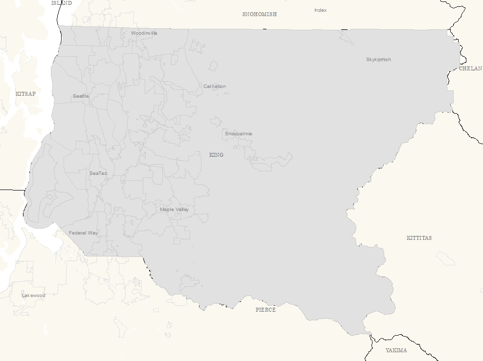
King County Place areas and names from 2000 Census
Layer information
| Layer Name | place00_area |
| Subject Category | Census |
| Title | 2000 Census Places |
| Feature Count | 78 |
| Feature Type | Polygon |
| Next Update | None planned |
| Spatial reference | EPSG:2926 |
| Control ID | 192 |
| Place Keywords | Washington State, King County, WA, Pacific NW |
| Theme Keywords | Demographic, Census, None |
| Supplemental Information |
None |
Attribute information
|
OBJECTID
From ESRI |
Description
Internal feature number. DomainSequential unique whole numbers that are automatically generated. |
|
PLACE
No Source Noted |
Description
Not Found DomainNot Found |
|
CNT_PLACE
No Source Noted |
Description
Not Found Domain7 to 2852 by 1 |
|
FILEID
No Source Noted |
Description
Not Found DomainNot Found |
|
STUSAB
No Source Noted |
Description
Not Found DomainNot Found |
|
SUMLEV
No Source Noted |
Description
Not Found DomainNot Found |
|
GEOCOMP
No Source Noted |
Description
Not Found DomainNot Found |
|
CHARITER
No Source Noted |
Description
Not Found DomainNot Found |
|
LOGRECNO
No Source Noted |
Description
Not Found DomainNot Found |
|
PLACECC
No Source Noted |
Description
Not Found DomainNot Found |
|
PLACEDC
No Source Noted |
Description
Not Found DomainNot Found |
|
PLACESC
No Source Noted |
Description
Not Found DomainNot Found |
|
MACCI
No Source Noted |
Description
Not Found Domain(no value), N, Y |
|
AREALAND
No Source Noted |
Description
Not Found DomainNot Found |
|
AREAWATR
No Source Noted |
Description
Not Found DomainNot Found |
|
NAME
No Source Noted |
Description
Not Found Domain(no value), Algona city, Ames Lake CDP, Auburn city, Baring CDP, Beaux Arts Village town, Bellevue city, Black Diamond city, Bothell city, Bryn Mawr-Skyway CDP, Burien city, Carnation city, Cascade-Fairwood CDP, Clyde Hill city, Cottage Lake CDP, Covington city, Des Moines city, Duvall city, East Hill-Meridian CDP, East Renton Highlands CDP, Eastgate CDP, Enumclaw city, Fall City CDP, Federal Way city, Hobart CDP, Hunts Point town, Inglewood-Finn Hill CDP, Issaquah city, Kenmore city, Kent city, Kingsgate CDP, Kirkland city, Lake Forest Park city, Lake Marcel-Stillwater CDP, Lake Morton-Berrydale CDP, Lakeland North CDP, Lakeland South CDP, Lea Hill CDP, Maple Heights-Lake Desire CDP, Maple Valley city, Medina city, Mercer Island city, Milton city, Mirrormont CDP, Newcastle city, Normandy Park city, North Bend city, Pacific city, Ravensdale CDP, Redmond city, Renton city, Riverbend CDP, Riverton-Boulevard Park CDP, Sammamish city, SeaTac city, Seattle - Ballard SA, Seattle - Capitol Hill SA, Seattle - Central SA, Seattle - Downtown SA, Seattle - Duwamish SA, Seattle - Lake Union SA, Seattle - North SA, Seattle - Northeast SA, Seattle - Northwest SA, Seattle - Queen Anne/Magnolia SA, Seattle - Southeast SA, Seattle - West Seattle SA, Shoreline city, Skykomish town, Snoqualmie city, Tanner CDP, Tukwila city, Union Hill-Novelty Hill CDP, Vashon CDP, West Lake Sammamish CDP, White Center CDP, Woodinville city, Yarrow Point town |
|
POP100
No Source Noted |
Description
Not Found DomainNot Found |
|
HU100
No Source Noted |
Description
Not Found DomainNot Found |
|
INTPTLAT
No Source Noted |
Description
Not Found DomainNot Found |
|
GCUNI
No Source Noted |
Description
Not Found Domain(no value), N, Y |
|
INTPTLON
No Source Noted |
Description
Not Found DomainNot Found |
|
LSADC
No Source Noted |
Description
Not Found Domain(no value), 57, 58, 60 |
|
FUNCSTAT
No Source Noted |
Description
Not Found Domain(no value), A, S |
|
SHAPE
From ESRI |
Description
Feature geometry. DomainCoordinates defining the features. |
|
Shape.STArea()
From SQL Server |
Description
Returns the area of a geometry instance in square units, based on the spatial reference identifier (SRID) of the geometry. DomainDouble |
|
Shape.STLength()
From SQL Server |
Description
Returns the total length of the elements in a geometry instance. DomainDouble |
Contact information
| Maintained by | KCGIS Center |
| Primary |
KCGIS Center
giscenter@kingcounty.gov |
Terms of Use
| License | Terms of use and copyright |
Use this Data
|
Links
How to use in ArcGIS Pro |
|
| Sharing Status | Not Public |
Summary
General locational reference
Description
King County Place areas and names from 2000 Census
Contact information
| Maintained by | KCGIS Center |
| Primary |
KCGIS Center
giscenter@kingcounty.gov |
Terms of use and copyright
| License | Terms of use and copyright |