
GIS Data Catalog
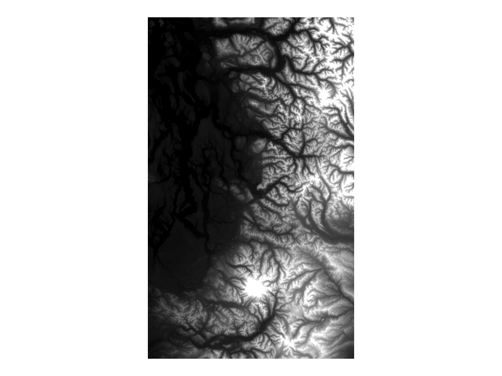
Cartographic Greyscale Hillshade for Puget Sound lowlands and Cascade Range
Learn more by reading the GIS FAQ 🗺
Summary
DEM and greyscale hillshade were created to serve as generalized cartographic backdrop where a regional view of elevation data is needed rather than high elevation accuracy.
Description
A smoothed and generalized version of the 28 meter NED elevation data and associated hillshade NED 28 meter data was resampled and generalized (smoothed) to reduce graphic artifacts.
Layer information
| Layer Name | SURFACE_NEDDEMCartographic |
| Subject Category | Imagery |
| Title | Cartographic Greyscale Hillshade for Puget Sound lowlands and Cascade Range |
| Feature Count | 1 |
| Feature Type | Raster |
| Next Update | As needed |
| Spatial reference | None |
| Control ID | None |
| Place Keywords | None |
| Theme Keywords | Topography, Elevation Model, Digital Elevation Model, Hillshade, Elevation |
| Supplemental Information |
All these datasets exist only at KeyRegion index level. |
Attribute information
|
OBJECTID
From ESRI |
Description
Internal feature number. DomainSequential unique whole numbers that are automatically generated. |
|
Shape
From ESRI |
Description
Feature geometry. DomainCoordinates defining the features. |
|
Shape_Length
From Esri |
Description
Length of feature in internal units. DomainPositive real numbers that are automatically generated. |
|
Shape_Area
From Esri |
Description
Area of feature in internal units squared. DomainPositive real numbers that are automatically generated. |
|
MosaicID
No Source Noted |
Description
Not Found DomainNot Found |
Contact information
| Maintained by | KCGIS Center |
| Primary |
KCGIS Center
giscenter@kingcounty.gov |
Terms of Use
| License | Terms of use and copyright |
Summary
DEM and greyscale hillshade were created to serve as generalized cartographic backdrop where a regional view of elevation data is needed rather than high elevation accuracy.
Description
A smoothed and generalized version of the 28 meter NED elevation data and associated hillshade NED 28 meter data was resampled and generalized (smoothed) to reduce graphic artifacts.
Contact information
| Maintained by | KCGIS Center |
| Primary |
KCGIS Center
giscenter@kingcounty.gov |
Terms of use and copyright
| License | Terms of use and copyright |
Change history
| 6/1/2005 |
Original NED 10-meter data by county has previously existed. In order to provide as seamless file and SDE image mosaic a smoothed generalized composite was created for the entire Puget Sound area. This type of mosaic already existed from the USGS 30 meter data, but starting with the 10 meter data allowed more artifacts to be removed Each county 10 meter DEM was processed in ArcInfo 9.x Workstation using the following command sequence: ARC - FILTER each DEM with a low pass filter (4x) GRID - RESAMPLE to 70 feet (based on an earlier version done only for King County) GRID - MERGE all grids to a single grid GRID - GRIDCLIP to form a neatline boundary GRID - FOCALMEAN using a RECTANGLE 3x3 matrix to remove scan lines ARC - HILLSHADE using an azimuth of 50 degrees and default bearing (315) with the SHADE argument ARC - GRIDIMAGE hillshade grid to tif image Copy grid reg_ned070 and image reg_nedghs070 to plibrary3/keyregion/elevation/. |