
GIS Data Catalog
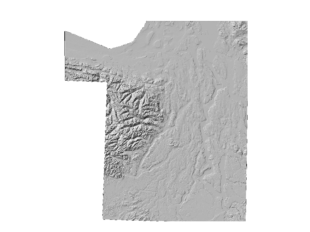
Cartographic Greyscale Hillshade from combined bathymetry and topography of the Puget Lowlands
Learn more by reading the GIS FAQ 🗺
Summary
Generalized cartographic display
Description
Default grey-scale hillshade derived from PSDEM2005 source data.
Layer information
| Layer Name | SURFACE_PSDEMHillshadeCartographic |
| Subject Category | Imagery |
| Title | Cartographic Greyscale Hillshade from combined bathymetry and topography of the Puget Lowlands |
| Feature Count | 1 |
| Feature Type | Raster |
| Next Update | None planned |
| Spatial reference | None |
| Control ID | None |
| Place Keywords | Pacific NW, Puget Sound Lowlands, Washington State |
| Theme Keywords | Elevation, Elevation Model, Digital Elevation Model, Hillshade, Topography |
| Supplemental Information |
All these datasets exist only at KeyRegion index level. |
Attribute information
|
OBJECTID
From ESRI |
Description
Internal feature number. DomainSequential unique whole numbers that are automatically generated. |
|
Shape
From ESRI |
Description
Feature geometry. DomainCoordinates defining the features. |
|
Shape_Length
From Esri |
Description
Length of feature in internal units. DomainPositive real numbers that are automatically generated. |
|
Shape_Area
From Esri |
Description
Area of feature in internal units squared. DomainPositive real numbers that are automatically generated. |
|
MosaicID
No Source Noted |
Description
Not Found DomainNot Found |
Contact information
| Maintained by | KCGIS Center |
| Primary |
KCGIS Center
giscenter@kingcounty.gov |
Terms of Use
| License | Terms of use and copyright |
Summary
Generalized cartographic display
Description
Default grey-scale hillshade derived from PSDEM2005 source data.
Contact information
| Maintained by | KCGIS Center |
| Primary |
KCGIS Center
giscenter@kingcounty.gov |
Terms of use and copyright
| License | Terms of use and copyright |
Change history
| 12/1/2005 |
Used ArcInfo 9.0 workstation ASCIIGRID command to convert ascii-formatted file to ESRI grid format |
| 12/1/2005 |
Used ArcInfo 9.0 workstation GRIDIMAGE command to create TIF version of GRID for distribution to Spatial Data Warehouse |
| 12/1/2005 |
Used ArcInfo 9.0 workstation HILLSHADE command with default arguements to create grey-scale hillshade from reprojected DEM. |
| 12/1/2005 |
Use MrSID GeoExpress v. 5 to convert TIFF to SID for posting to Spatial Data Warehouse. Image was compressed at approximately 7x. |
| 12/1/2005 |
Use ArcInfo 9.0 workstation PROJECTDEFINE to establish Washington State Plane North, NAD 83, units Feet projection header. Used PROJECTGRID command to reproject grid to HARN. |
| 12/1/2005 |
Downloaded and unzipped psdem_2005.asc from http://www.ocean.washington.edu/data/pugetsound/psdem2005.html |