
GIS Data Catalog
Vashon-Maury Island Shoreline Building Footprints
Learn how to get an ArcGIS Online account 🗺
Use this Data
|
Links
How to use in ArcGIS Pro |
|
| Sharing Status | Not Public |
Summary
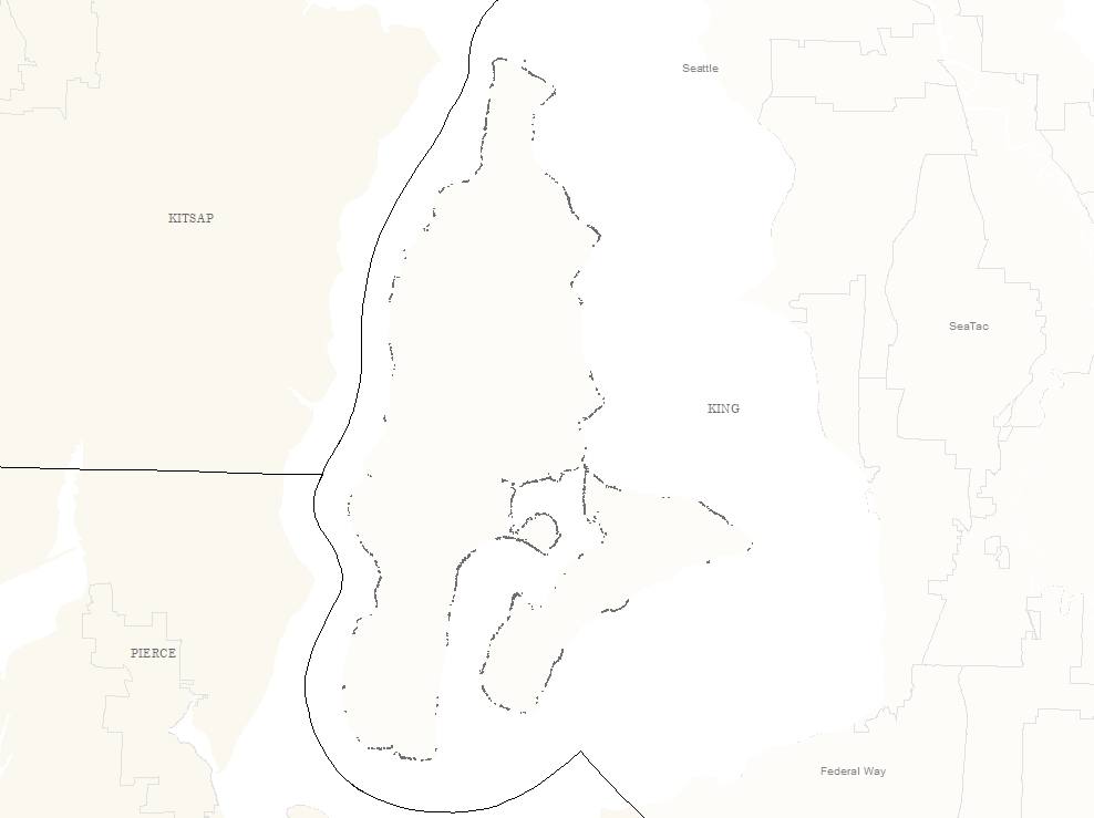
This layer contains all buildings in the Coastal High Hazard Area (FEMA High Risk Flood Areas/100-yr Floodplain), Sea-Level Rise Risk Area, or 100 feet landward of the Sea-Level Rise Risk Area for Vashon-Maury Island.
This layer is used for tracking development in the aforementioned hazard areas, as well as for tracking progress towards goals laid out in the Clean Water Healthy Habitats initiative.
This layer will be updated over time as new development or demolitions occur.
Description
This layer contains all buildings in the Coastal High Hazard Area (FEMA High Risk Flood Areas/100-yr Floodplain), Sea-Level Rise Risk Area, or 100 feet landward of the Sea-Level Rise Risk Area for Vashon-Maury Island.
For the purposes of this layer, temporary structures or structures without walls (such as a carport) are not included.Building outlines in the layer were first generated in 2012 as part of a flood study on Vashon-Maury Island using 2009 aerial imagery.
These data were used as a starting point for the 2024-2025 effort.
In the 2024-2025 effort, GIS analysts at King County reviewed all existing buildings, edited geometry and/or added buildings as necessary, and deleted buildings where there were bad digitizations.
As a main purpose of this data is to track progress towards goals in the Clean Water Healthy Habitats (CWHH) initiative, buildings that were demolished are retained in this dataset and flagged as such.
It is important to note that features in this dataset may be demolished buildings that do not exist anymore.
Tracking these improvements relative the CWHH goals is a critical function of this dataset.A number of attributes relevant to tracking expansion or contraction of development in the shoreline area are included in this data and described in attribute (fields) section of the metadata.
For questions about the project and/or project goals, contact Kollin Higgins at kollin.higgins@kingcounty.gov.
More information about the CWHH initiative can be found here: https://kingcounty.gov/en/dept/dnrp/about-king-county/about-dnrp/sustainability-commitments/clean-water-healthy-habitat
Layer information
| Layer Name | vashonmauryshorelinebuildings_area |
| Subject Category | Environment |
| Title | Vashon-Maury Island Shoreline Building Footprints |
| Feature Count | 2089 |
| Feature Type | Polygon |
| Next Update | Irregular |
| Spatial reference | EPSG:2926 |
| Control ID | 3023 |
| Place Keywords | Washington State, King County, WA, Pacific NW |
| Theme Keywords | Enviro |
| Supplemental Information | None |
Attribute information
|
OBJECTID
From Esri |
Description
Internal feature number. DomainSequential unique whole numbers that are automatically generated. |
|
pin
From King County |
Description
Parcel ID Number from the King County Assessor for the parcel within which the building exists. If this field is <null>, that indicates that the building is in the public right-of-way. DomainThe parcel ID number uses 10-digit numbers, often with leading zeros, to uniquely identify parcels in King County. |
|
building_type
From King County |
Description
This field describes the type of building. Building type was determined by a combination of reviewing aerial imagery from multiple years, reviewing King County Assessor data, and consulting with subject matter experts and KC employees familiar with the area. In all cases, this is the best approximation of building use type. DomainBoathouse - Boathouse: Small structure immediately adjacent to shoreline with primary use of boating or other aquatic recreation. Detached_garage - Detached Garage: garage structure that is detached from other structures and within which another dominant use type cannot be confirmed. MFR - Multi Family Residence: residential dwelling unit that shares walls with one or more other residential dwelling units. Non-Residential - Non-Residential: commercial or other non-residential building type. Res_accessory - Residential Accessory Structure: accessory dwelling unit (ADU) or other living space that is not the primary residence but appears to be occupied. Analysts used the presence of windows, skylights, vent stacks, and other features in the aerial and oblique imagery to assess the most likely possible building use type. Shed - Shed: small storage building in which other use types cannot be confirmed. Shed (less than or equal to 200 sq ft) - Shed (less than or equal to 200 sq ft): small storage building less than or equal to 200 sq ft. Shed (> 200 sq ft) - Shed (> 200 sq ft): storage building greater than 200 sq ft. SFR - Single Family Residence: detached dwelling unit that is the primary residence on a residential property. Unclear_other - Unclear/other: retained building type for buildings which the use type was not able to be determined. Unknown Med - Unknown Med. Sized Building: retained building type for buildings which the use type was not able to be determined, generally greater than 400 sq ft. Unknown Small Sized Building - Unknown Small Sized Building: retained building type for buildings which the use type was not able to be determined, generally less than 400 sq ft. |
|
rfms_present
From King County |
Description
This is a binary yes/no field indicating whether this building was present in the source dataset from 2012 that was based on 2009 imagery. Domainno - no: not present in the 2012 study yes - yes: present in the 2012 study |
|
rfms_area
From King County |
Description
This was the recorded footprint area for the building if it existed in the 2012 study based on 2009 imagery. If this field is <null>, then it indicates that the building did not exist in that dataset. Domain0.0 to 12503.9361961 by |
|
aerial_2023
From King County |
Description
This is a binary field indicating whether or not the building is visible in the 2023 aerial imagery. This can refer to either the top down orthoimagery or the oblique-view imagery. Domainno - no: not visible in 2023 imagery yes - yes: visible in 2023 imagery |
|
rfms_missed
From King County |
Description
This is a binary yes/no field indicating whether the given feature was missed in the 2012 study based on 2009 imagery. Domainno - no: this building was not missed in the 2012 data based on 2009 imagery yes - yes: this building existed in 2009 but was not included in the 2012 dataset, therefor was missed in that study. |
|
footprint_increase
From King County |
Description
This is binary yes/no field to indicate whether or not the building had an increase in footprint area between 2009 and 2023, as evidenced in the aerial imagery. Domainno - no: there was no increase in building footprint area yes - yes: there was an increase in building footprint area |
|
change_direction
From King County |
Description
This field indicates the direction of change between 2009 and 2023. In this case, improvement = decrease in footprint area and degradation = increase in footprint area. Domaindegradation - Degradation: there has been an increase in footprint area, or a building has been built where one did not exist before. improvement - Improvement: there has been a decrease in footprint area, or a building has been completely demolished. no_change - No Change: there has been no change in footprint area. |
|
footprint_area
From King County |
Description
This is the square feet footprint area of the structure in this dataset. Domain0.0 to 12503.9361963 by |
|
geom_edit_update
From King County |
Description
This field was used throughout the editing process to track the status of feature geometry review and edits. Domainremoval_bad digitization - flag for removal - bad digitization: The feature was wrongly digitized and included in the 2012 study and has been flagged for removal in this dataset. mod_previous error - footprint modified - previous error: This feature was incorrectly digitized in the 2012 data and has been modified. mod_structure change - footprint modified - structure change: There has been a change in footprint area due to a modification of the structure. needs_review - needs review: flagged status for review by editor team. newly built - newly built: this structure didn't exist in 2009 and has been built between 2009-2023. newly digitized - newly digitized: this structure existed in 2009, but was missed in the 2012 dataset, and has been digitized for inclusion in this dataset. no_change_required - no change required: this building was unchanged between 2009-2023 no_longer_exists - no longer exists: this building no longer exists. Note: this feature remains in the dataset in order to track buildings that have been physically removed. |
|
floodplain_coastalhighhaz
From King County |
Description
Binary yes/no field to indicate if the building intersects with the Coast High Hazard Area (FEMA High Risk Flood Areas/100-yr Floodplains). Domainno - no: does not intersect with the coastal high hazard area yes - yes: does intersect with the coastal high hazard area |
|
floodplain_pctintersect
From King County |
Description
Percent of the building that intersects the Coastal High Hazard Area (FEMA High Risk Flood Areas) Domain0.0 to 1.0000001 by |
|
slr_riskarea
From King County |
Description
Binary yes/no field to indicate if the building intersects with the sea-level rise risk area. Domainno - no: the building does not intersect with the SLR risk area yes - yes: the building does intersect with the SLR risk area |
|
slr_riskarea_pctintersect
From King County |
Description
Percent of the building that intersects the sea-level rise risk area. Domain0.0 to 1.00000049 by |
|
yr_built
From King County |
Description
Year built as determined by the King County Assessor database. Generally, this was only able to be determined for primary structures on a given parcel. Domain1900.0 to 2023.0 by |
|
notes
From King County |
Description
This is a general notes field to capture information relevant to the structure or to the editor teams classification of building type. DomainThis is a simple notes field of up to 256 characters. |
|
yr_renovated
From King County |
Description
This is the effective year built as determined by the King County Assessor database. Generally, this was only able to be determined for primary structures on a given parcel. Domain1944.0 to 2023.0 by |
|
shoreline_parcel
From King County |
Description
This is binary yes/no field to indicate whether or not the building is within a shoreline parcel. For the purpose of this study, a shoreline parcel is defined as any parcel that intersects the Shoreline Master Program shoreline area. Domainno - no: the parent parcel does not intersect the SMP shoreline area yes - yes: the parent parcel does intersect the SMP shoreline area |
|
globalid
From King County |
Description
An ID field automatically generated by ArcGIS Enterprise during the editing process. DomainUNREPRESENTED DOMAIN |
|
Shape
From Esri |
Description
Feature geometry. DomainCoordinates defining the features. |
|
Shape.STArea()
From ArcGIS Pro |
Description
Feature area in square feet. DomainShape area |
|
Shape.STLength()
From ArcGIS Pro |
Description
Feature perimeter length in linear feet. DomainShape perimeter |
Contact information
| Maintained by | DNRP - Water and Land Resources |
| Primary |
Harkeerat Kang
Harkeerat.Kang@kingcounty.gov |
Terms of Use
| License | Terms of use and copyright |
Use this Data
|
Links
How to use in ArcGIS Pro |
|
| Sharing Status | Not Public |
Summary
This layer contains all buildings in the Coastal High Hazard Area (FEMA High Risk Flood Areas/100-yr Floodplain), Sea-Level Rise Risk Area, or 100 feet landward of the Sea-Level Rise Risk Area for Vashon-Maury Island.
This layer is used for tracking development in the aforementioned hazard areas, as well as for tracking progress towards goals laid out in the Clean Water Healthy Habitats initiative.
This layer will be updated over time as new development or demolitions occur.
Description
This layer contains all buildings in the Coastal High Hazard Area (FEMA High Risk Flood Areas/100-yr Floodplain), Sea-Level Rise Risk Area, or 100 feet landward of the Sea-Level Rise Risk Area for Vashon-Maury Island.
For the purposes of this layer, temporary structures or structures without walls (such as a carport) are not included.Building outlines in the layer were first generated in 2012 as part of a flood study on Vashon-Maury Island using 2009 aerial imagery.
These data were used as a starting point for the 2024-2025 effort.
In the 2024-2025 effort, GIS analysts at King County reviewed all existing buildings, edited geometry and/or added buildings as necessary, and deleted buildings where there were bad digitizations.
As a main purpose of this data is to track progress towards goals in the Clean Water Healthy Habitats (CWHH) initiative, buildings that were demolished are retained in this dataset and flagged as such.
It is important to note that features in this dataset may be demolished buildings that do not exist anymore.
Tracking these improvements relative the CWHH goals is a critical function of this dataset.A number of attributes relevant to tracking expansion or contraction of development in the shoreline area are included in this data and described in attribute (fields) section of the metadata.
For questions about the project and/or project goals, contact Kollin Higgins at kollin.higgins@kingcounty.gov.
More information about the CWHH initiative can be found here: https://kingcounty.gov/en/dept/dnrp/about-king-county/about-dnrp/sustainability-commitments/clean-water-healthy-habitat
Contact information
| Maintained by | DNRP - Water and Land Resources |
| Primary |
Harkeerat Kang
Harkeerat.Kang@kingcounty.gov |
Terms of use and copyright
| License | Terms of use and copyright |